


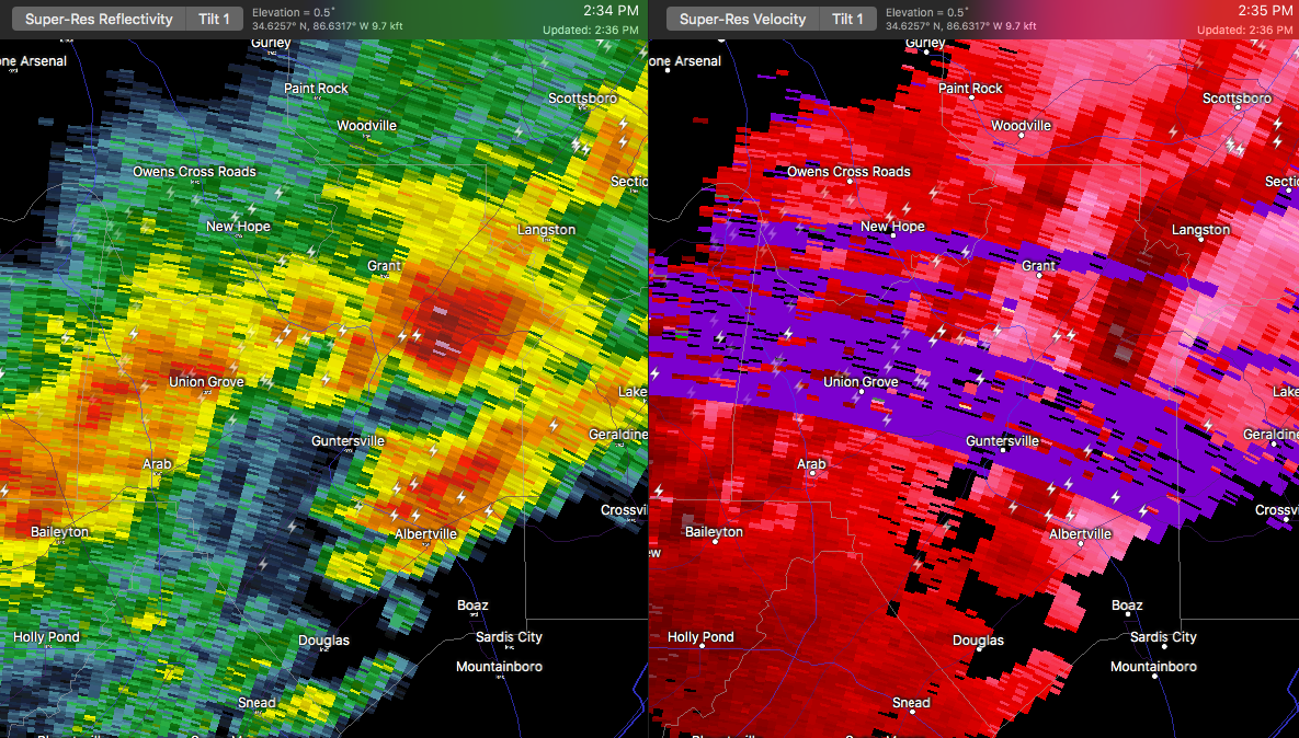

…A SEVERE THUNDERSTORM WARNING REMAINS IN EFFECT UNTIL 245 PM CST FOR NORTHEASTERN MARSHALL COUNTY… At 232 PM CST, a severe thunderstorm was located near Grant, or near Guntersville, moving east at 55 mph.
HAZARD…60 mph wind gusts and quarter size hail.
SOURCE…Public. At about 220 PM, quarter size hail was reported in the town of Hebron.
IMPACT…Hail damage to vehicles is expected. Expect wind damage to roofs, siding, and trees. Locations impacted include… Guntersville, Grant, Hebron, Columbus City and Lake Guntersville St Park.
Severe Thunderstorm Warning Continues For Parts Of Marshall County Until 2:45PM
Mar 1st @ 2:11 pm

…A SEVERE THUNDERSTORM WARNING REMAINS IN EFFECT UNTIL 245 PM CST FOR MARSHALL COUNTY… At 220 PM CST, a severe thunderstorm was located near Union Grove, moving east at 50 mph.
HAZARD…60 mph wind gusts and half dollar size hail.
SOURCE…Radar indicated.
IMPACT…Hail damage to vehicles is expected. Expect wind damage to roofs, siding, and trees. Locations impacted include… Guntersville, Arab, Grant, Union Grove, Columbus City, Lake Guntersville St Park, Eddy, Hebron, Hustleville and Mountain View.
Severe Thunderstorm Warning Canceled For Parts Of Morgan County Until 2:45PM
Mar 1st @ 2:11 pm
…THE SEVERE THUNDERSTORM WARNING FOR SOUTHEASTERN MORGAN COUNTY IS
CANCELLED…
The severe thunderstorm which prompted the warning has moved out of
southeastern Morgan County. Therefore, the warning has been
cancelled.
A tornado watch remains in effect until 600 PM CST for north central
and northeastern Alabama.
Severe Thunderstorm Warning Issued For Parts Of Marshall And Morgan Counties Until 2:45PM
Mar 1st @ 2:11 pm

The National Weather Service in Huntsville Alabama has issued a
* Severe Thunderstorm Warning for…
Marshall County in northeastern Alabama…
Southeastern Morgan County in north central Alabama…
* Until 245 PM CST
* At 210 PM CST, a severe thunderstorm was located near Morgan City, or 8 miles northwest of Arab, moving east at 50 mph.
HAZARD…60 mph wind gusts and half dollar size hail.
SOURCE…Radar indicated.
IMPACT…Hail damage to vehicles is expected. Expect wind damage to roofs, siding, and trees.
* Locations impacted include…
Guntersville, Arab, Grant, Morgan City, Union Grove, Hulaco, Lake
Guntersville St Park, Hebron, Ryan Crossroads and Columbus City.



