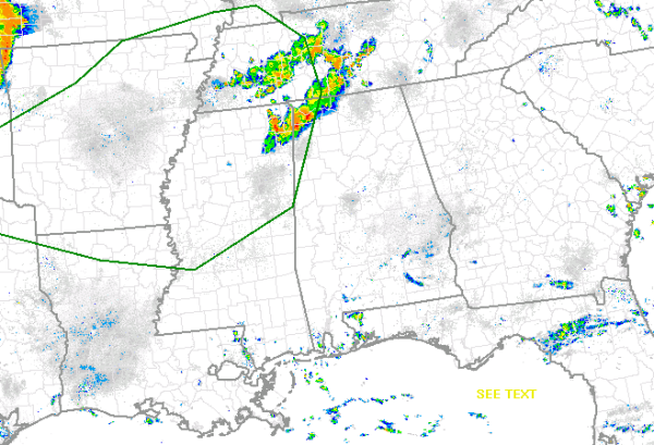
In the latest day one convective outlook issued by the SPC, that have extended a slight risk for severe weather into portions of extreme Northwest Alabama. As of now, this risk is just for the counties that make up the western boarder of the state. It includes portions of Pickens, Lamar, Marion, Franklin, Colbert and Lauderdale Counties.
This morning there are ongoing thunderstorms in the area, currently none of these storms are severe. They are strong and could be producing hail, gusty winds, frequent lightning and heavy rain. Flash flooding could develop in these areas too. The main concern for severe weather today is expected later today as a MCS moving from the southern Plains is expected to cross the Mississippi Valley. Daytime heating is expected to destabilize the atmosphere more today and re-intensification of these storms is expected. They could produce large hail and damaging winds.
We will also be watching for a flash flood threat across the rest of the state for the next couple of days as an area of low pressure in the Gulf will slowly be working north. It caused some flash flooding overnight along the Interstate 85 corridor in Macon, Bullock, and Russell Counties. Several roads were reported to be impassible due to high water.