


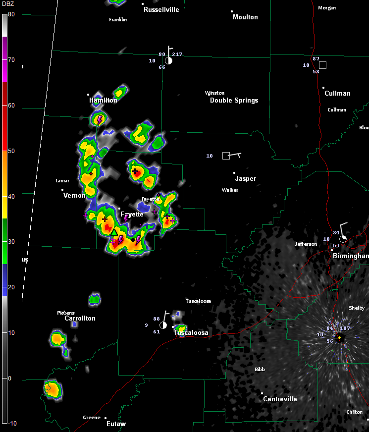
Showers and storms are forming across West Alabama at this hour.
The main concentration is over southern Marion, Lamar and Fayette Counties. They are pushing south southwestward and will also affect parts of northwestern Tuscaloosa and northern Pickens Counties in the next hour.
Other cells were developing a little further to the south of the main grouping over Pickens Tuscaloosa Counties. Growing showers were around McFarland Blvd. in Tuscaloosa.
A growing cell was east of Geiger on the Tombigbee River between Greene and Sumter Counties.
More cells were over Northwest Alabama around the Quad Cities.
Other storms are forming over Tennessee. These will affect Northeast Alabama over the next couple of hours as well.
Nothing severe, although a couple of warnings can’t be ruled out. The stronger storms will produce small hail and gusty winds however. Dangerous cloud to ground lightning and brief heavy rain will also occur.



