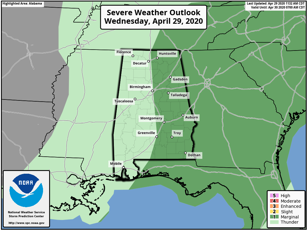
RADAR CHECK: Showers and thunderstorms continue to develop over the northern half of Alabama this afternoon. Heavier storms will be capable of strong gusty winds and some small hail, but the severe weather threat is practically over. A morning thunderstorm complex on the Gulf Coast helped to block the inflow of moist air up into the northern half of the state, reducing instability. SPC still maintains a low end “marginal risk” (level 1/5) for the eastern half of the state.
Showers and storms will end early tonight.
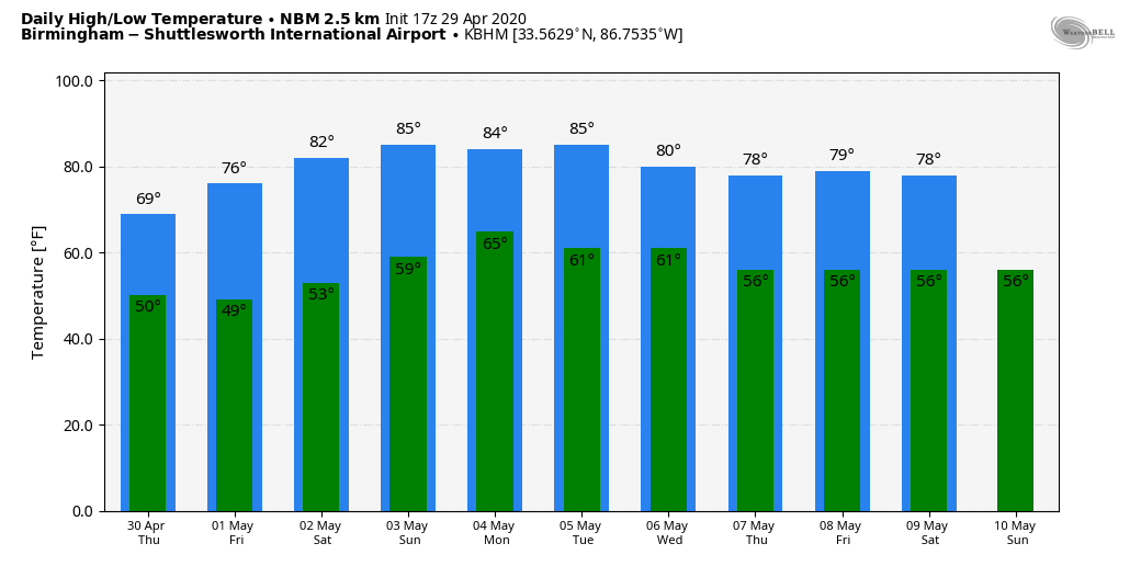
TOMORROW THROUGH THE WEEKEND: The sky becomes partly sunny across most of the state tomorrow after some lingering morning clouds, but the sky could remain mostly cloudy through the day over the northeast part of the state. Where clouds linger tomorrow, the high will be in the 60s. Expect low 70s elsewhere, about 5 degrees below average for late April in Alabama.
Look for sunshine in full supply Friday and Saturday along with a warming trend; the high Friday will be in the mid to upper 70s, followed by 82-85 degree warmth Saturday. Sunday will stay warm and dry; partly sunny with a high in the mid 80s.
NEXT WEEK: A weak surface front will bring some risk of scattered showers Monday and Tuesday, but rain amounts should be light. Then, the latter half of the week looks dry and cooler. See the Weather Xtreme video for maps, graphics, and more details.
ON THIS DATE IN 1987: A storm off the southeast coast of Massachusetts blanketed southern New England with heavy snow on the 28 through the 29th. Totals of three inches at Boston, 11 inches at Milton, and 17 inches at Worcester Massachusetts were records for so late in the season. Princeton Massachusetts was buried under 25 inches of snow.
BEACH FORECAST: Click here to see the AlabamaWx Beach Forecast Center page.
WEATHER BRAINS: Don’t forget you can listen to our weekly 90 minute show anytime on your favorite podcast app. This is the show all about weather featuring many familiar voices, including our meteorologists here at ABC 33/40.
CONNECT: You can find me on all of the major social networks…
Facebook
Twitter
Instagram
Pinterest
Snapchat: spannwx
Look for the next Weather Xtreme video here by 7:00 a.m. tomorrow…