


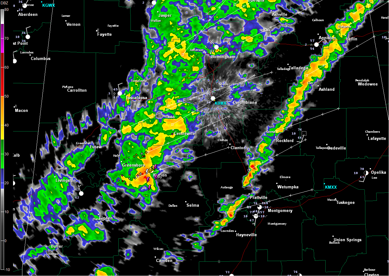
A post frontal band of showers is progressing across Alabama tonight, with a thin line of heavy showers just ahead of it along the actual cold front.
There is one heavy thunderstorm approaching Marion in Perry County with frequent lightning and heavy rain. It will make it into Chilton County around Maplesville before 7:15 and move to near Clanton just after 7:30. No a threat to become severe right now. In fact, the storm seems to have weakened a bit in the past few radar scans.
There could be a little lightning in the cell in Clay County as well, although it is not showing up on my lightning output right now.
The cold air is oozing southeastward. It is 36F in Columbus MS and 76F just down highway 82 in Montgomery last hour.
It”s 18F at Harrison in NW Arkansas and 3F at Denver. It is a bone chilling -17F at Glasgow, MT.
The I-59 corridor should get to the middle 30s overnight, with readings below freezing over Northwest Alabama. The rain is ending in Northwest Alabama but may not come to a complete end for everyone in the I-59 corridor overnight. Scattered showers will continue in the 59 corridor and points southeast Saturday morning, increasing areawide tomorrow afternoon.
Highs tomorrow will range from the lower 40s Northwest to upper 40s in the 59 corridor to lower 50s Southeast.



