


Daily Weather Briefing
Sunday, June 21, 2026
ALABAMA THIS MORNING
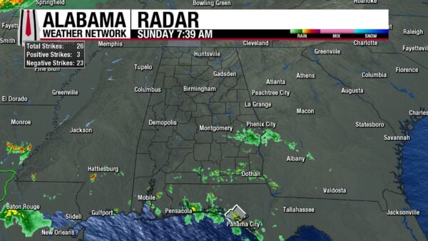
This morning is partly to mostly cloudy and humid, as temperatures and dewpoints sit in the lower 70s. Some light showers spread across south Alabama, in Unions Springs, Hurtsboro, Dothan, Ozark, Daleville, Opp, Paul, Stapleton, Fairhope, and Creola. Otherwise, the state is dry.
ALABAMA’S 7 DAY FORECAST
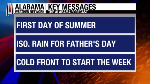
The passage of an upper-level trough and the lifting of a frontal boundary north will bring showers and thunderstorms to the south today. Central and north Alabama will be drier, with a low chance of an isolated or scattered thunderstorm. Tomorrow flips and the north will see a high chance of rain while the south will be mostly dry as an upper-level shortwave moves through the north. There is a low-end severe weather threat for the northern two-thirds of the state Monday. A frontal boundary will stall south over central Alabama Tuesday, bringing medium rain chances to the entire state. We enter a more typical summer pattern of afternoon showers and thunderstorms Wednesday through Friday, and that should continue into the weekend.
FATHER’S DAY FORECAST
If you have outdoor Father’s Day plans today, they should be mostly rain-free in the northern half of the state. There is a low chance of a scattered shower or thunderstorm that could move through the region in the afternoon/evening time, but no washouts are expected. Highs will be in the mid to upper 80s. Any outdoor plans in the south should be reconsidered. Showers and thunderstorms will be relatively scattered to widespread throughout the day, with many expected to be slow-moving, efficient rainfall producers, bringing up flash flood concerns. Additionally, some storms will carry strong winds. Highs will hit the upper 80s and lower 90s.
WET NORTH, DRIER SOUTH TOMORROW
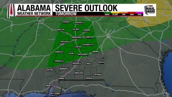
An upper-level shortwave will bring showers and thunderstorms to north Alabama, although timing is difficult with models disagreeing. Regardless, when the storms come through, expect some severe ones as the Storm Prediction Center has placed the northern two-thirds of the state under a Marginal Risk (1/5) of Severe Thunderstorms, with damaging winds and heavy rainfall the main concerns. South Alabama should be mostly dry, with isolated to scattered showers possible in the afternoon and evening. Highs will climb to the upper 80s north and upper 80s to lower 90s centrally and in the south. Feels-like temperatures will venture into the mid 90s to even 100 degrees.
FRONTAL BOUNDARY BRINGS MORE RAIN TUESDAY
A frontal boundary will stall over the state on Tuesday and will keep rain chances in the 40-60% range statewide. The lower end of the range will be in the north, the higher range in the south. Thunderstorms will be sub-severe, but a strong storm with gusty winds is possible. Highs will rise to the mid to upper 80s from north to south-central Alabama. The south will see highs hit the lower 90s, with even a few mid-90 readings. Heat index (feels-like) values will be hot once again.
SUMMER SHOWER PATTERN RETURNS WEDNESDAY
After a week and some change of large-scale rainfall producing weather systems, we should fall back into the more typical summer pattern of afternoon shower and thunderstorms driven by daytime heating. This brings rainfall chances to 50% statewide Wednesday. Highs will range from the mid 80s north to the upper 80s and lower 90s south.
Rain chances decrease Thursday to 30% in the northern half of the state and 40% in the southern half while highs hit the upper 80s and lower 90s in the north and south respectively.
A 30% chance of showers and thunderstorms spreads over Alabama Friday as highs once again reach the upper 80s and lower 90s.
POSSIBLY DRIER THIS WEEKEND
We should dry out a little more by Saturday. The northern half of the state will hold onto its 30% chance of thunderstorms, while the southern half falls to a 20% chance. Highs will stay in the upper 80s and lower 90s range.
RAINFALL OUTLOOK
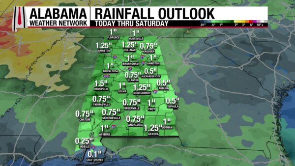
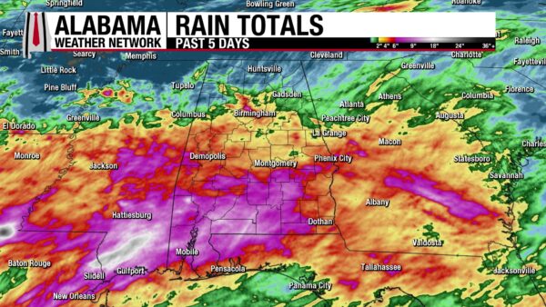
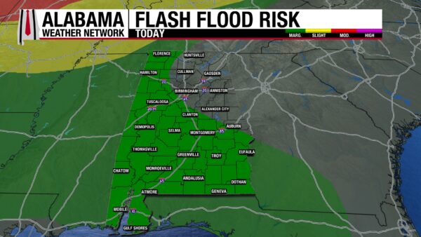
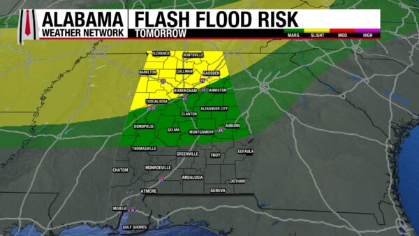
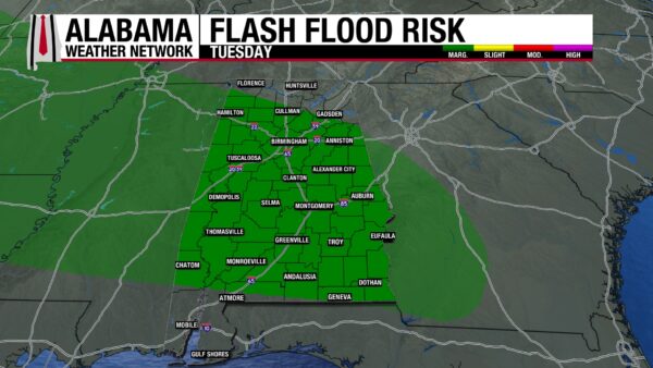
Despite the chance for some efficient rainfall producing storms and multiple days of an elevated flash flood risk, the state is only expecting to see half an inch to an inch and a half of rainfall over the next seven days. This is not a lot of rain compared to what we have seen recently, with places in north Jefferson County and in much of the southwest seeing anywhere from 6-10 inches of rain over the past 5 days. But because we have seen that much rain recently, it will not take much to cause flash flooding, so the Weather Prediction Center has placed west and south Alabama under a Marginal Risk for Flash Flooding today. Tomorrow, a Slight Risk (2/4) extends across the north and into west-central Alabama. A Marginal Risk stretches down into the rest of central Alabama Monday. On Tuesday, a Marginal Risk excludes only northeast Alabama and Mobile, and Baldwin Counties.
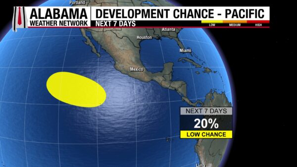
ANOTHER AREA TO WATCH IN THE PACIFIC
The Pacific has been quiet for a few days, but there is now an area of interest with a 20% chance of development in the next seven days. It currently moves to the west/northwest at 10 to 15 mph.
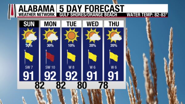
DODGING SHOWERS TODAY
A 30% chance of showers and thunderstorms will have beachgoers dodging the rain today. Otherwise, conditions are nice. The high will be in the low 90s, skies will be partly sunny, and the UV Index will be Very High. Winds will come from the southwest at 10 mph, providing a nice breeze. The water has calmed some, with the rip current risk at Moderate now, and the surf height at 2 to 3 feet. This does not mean you should let your guard down though, as rip currents are still possible and can be dangerous. Rain chances stay at 30% tomorrow, then decrease to 10-20% through the week making for a great day week on the shore.
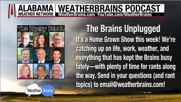
WEATHERBRAINS 1066
Tomorrow’s WeatherBrains episode is a home-grown show! No special guests, just catching up on life! Catch the episode wherever you get your podcasts or watch here!
TODAY IN WEATHER HISTORY
June 21, 2023 – Hail at Red Rocks
June 21, 2023, was already a remarkable weather day in Colorado before the storm reached Red Rocks. Across the northeast part of the state, slow-moving supercells spun out tornado after tornado over the open plains. The National Weather Service in Boulder later confirmed 37 tornadoes that day, the largest number ever documented in Colorado on a single calendar day, though forecasters were careful to note that modern cameras, chasers, and reporting technology make comparisons with older events difficult.
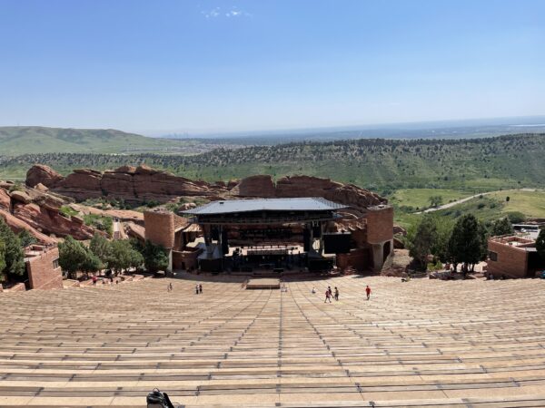
By evening, the focus shifted west toward the foothills near Morrison, where thousands of fans had gathered at Red Rocks Amphitheatre for a Louis Tomlinson concert. The setting is famous for its beauty: steep stone seating, towering red sandstone walls, and a wide-open view of the sky. That same openness became the danger. Red Rocks is spectacular in fair weather, but in a severe thunderstorm, there are few quick places for a large crowd to hide. The atmosphere had been primed for severe storms, and hail was one of the main threats. By around 9:20 PM MDT, the storm hit Red Rocks with hail around 2 inches in diameter, roughly hen-egg size and larger than a golf ball.
The timing was brutal. The venue had gone into weather delay earlier in the evening, then received an all-clear, only for another dangerous storm to approach. As fans tried to move toward vehicles and shelter, hail began pounding the amphitheatre. People ducked under clothing, signs, bags, concession areas, and anything they could find. Some slipped on accumulating hail. Others were struck directly on the head, arms, shoulders, and back as ice bounced down the rows and piled on the ground. 80 to 90 people were treated for injuries, ranging from cuts and bruises to broken bones, and 7 were transported to hospitals.
The Red Rocks storm did not reach the scale of the 1995 Mayfest hailstorm in Fort Worth, but it became another major example of hail turning a crowded outdoor venue into a mass-injury scene. It also fit into a much larger national pattern. June 2023 was an extraordinary month for large hail across the United States, with preliminary SPC-based tallies showing the highest monthly number of 2-inch-or-larger hail reports in the modern online record beginning in 2004. The Red Rocks storm stood out not because it produced the largest hail of the month, but because it struck a dense outdoor crowd with limited shelter options.
IMAGE(S) OF THE DAY
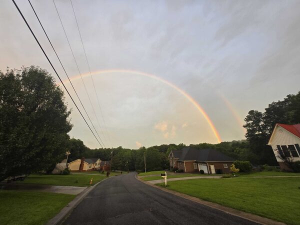
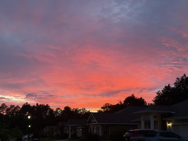
Our Skywatchers are making the Image of the Day choices hard! Here’s two:
1. Skywatcher Spencer Williams took a wonderful picture of a double rainbow in Green Top Hill last night.
2. Skywatcher Christian Lazenby sent this amazing photo of the sky on fire in Fairhope last night.

Happy Father’s Day from the Alabama Weather Network!



