…SIGNIFICANT WEATHER ADVISORY FOR SOUTHWESTERN COLBERT AND NORTHERN
FRANKLIN COUNTIES UNTIL 345 PM CDT…
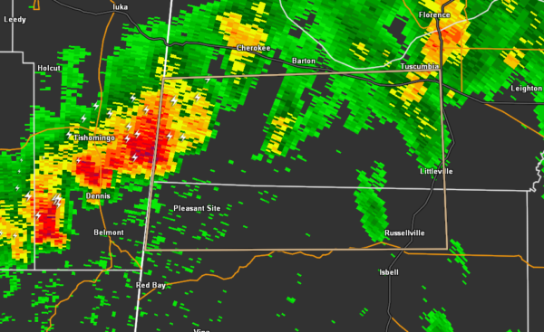
At 316 PM CDT, Doppler radar was tracking a strong thunderstorm near
Tishomingo State Park, moving east at 35 mph.
Pea size hail and winds in excess of 30 mph will be possible with
this storm.
Locations impacted include…
Muscle Shoals, Russellville, Tuscumbia, Littleville, Posey Loop,
Pogo, Cedar Creek Reservoir, Srygley Church, New Bethel and Maud.
PRECAUTIONARY/PREPAREDNESS ACTIONS…
Strong gusty winds will be capable of knocking down small tree limbs
along with other small unsecured items. Seek safe shelter until this
storm has passed.
Frequent cloud to ground lightning is occurring with this storm.
Lightning can strike several miles away from a thunderstorm. Seek a
safe shelter inside a building or vehicle.