ALZ025-026-272330-
Shelby AL-St. Clair AL-
554 PM CDT Tue Aug 27 2019
…SIGNIFICANT WEATHER ADVISORY FOR NORTHEASTERN SHELBY AND CENTRAL
ST. CLAIR COUNTIES UNTIL 630 PM CDT…
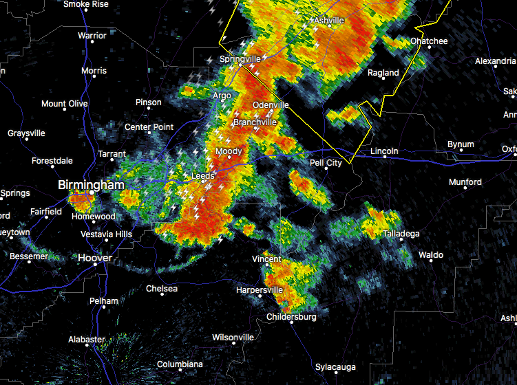
At 553 PM CDT, Doppler radar was tracking strong thunderstorms along
a line extending from near Springville to near Mount Laurel. Movement
was southeast at 25 mph.
Dime size hail and winds in excess of 40 mph will be possible with
these storms.
Locations impacted include…
Pell City, Leeds, Moody, Chelsea, Springville, Odenville,
Wilsonville, Margaret, Argo, Riverside, Vincent, Harpersville,
Westover, Bald Rock, Vandiver, Branchville, Greystone, Highland
Lakes, Logan Martin Lake and Fowler Lake.