


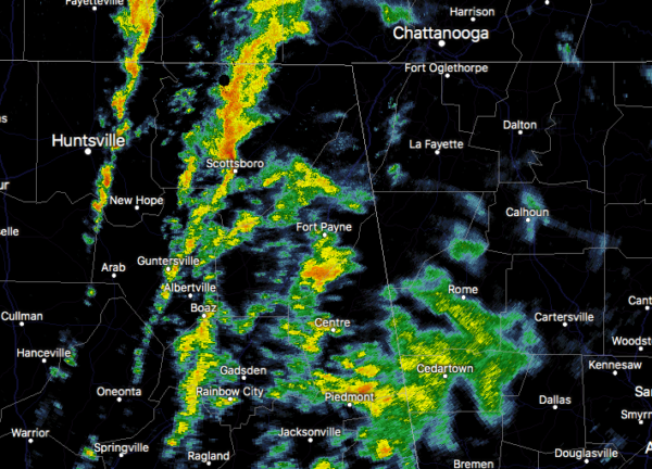
At 547 PM CDT, Doppler radar was tracking a band of moderate to
heavy showers extending from 8 miles west of Manchester to near
Huntland to 6 miles south of Morgan City. Movement of this band
was to the northeast at 45 mph.
Wind gusts of 30 to 40 mph will be possible with these showers.
Locations impacted include…
Huntsville, Scottsboro, Winchester, Guntersville, Moores Mill,
Meridianville, Lynchburg, Redstone Arsenal, Hazel Green and Decherd.
PRECAUTIONARY/PREPAREDNESS ACTIONS…
Strong gusty winds will be capable of knocking down small tree
limbs, power lines and other small unsecured items. Seek safe
shelter until this line of showers has passed.
Very heavy rainfall is also occurring with these showers, and may
lead to localized flooding. Do not drive your vehicle through
flooded roadways.



