


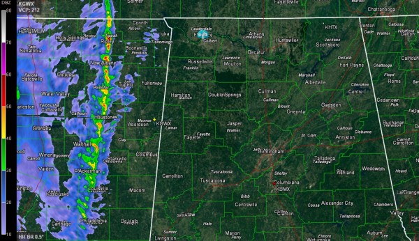
A line of intense showers is progressing eastward through eastern Mississippi tonight. It extends from New Albany to Pontotoc to Houston to Louisville and Philadelphia.
It is only moving east at about 15-20 mph.
The showers are too short to produce lightning, averaging only 20-25,000 feet in altitude. They are barely even visible to the Birmingham radar, nearly 150 miles away. The radar beam is nearly 20,000 feet off the ground at that point as the earth curves down and away from it.
The showers will reach West Central Alabama around midnight and I-65 around 3-4 a.m. They should be into Georgia over East Alabama by 7 a.m
There is no severe weather threat with the line of showers, but winds are still gusting to over 25 mph over Alabama. Winds gusted to 37 mph at Muscle Shoals last hour. There was some minor wind damage in Mississippi with the line as it passed, so it is not improbable that there could be a couple of trees down or minor wind damage in Alabama overnight with the strong gradient winds.



