


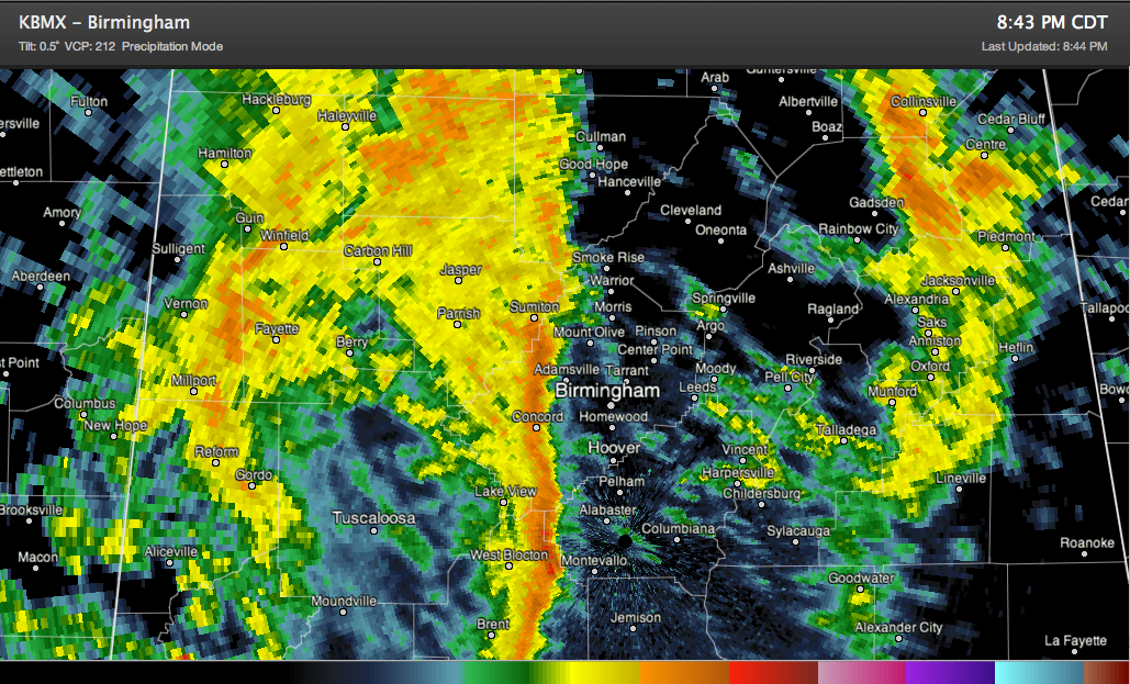
A cold front is working its way slowly across Central Alabama tonight. It has reached western Jefferson County. Its forward speed is less than 15 mph, and it should slow even further overnight. This hour, it is 62F at the Birmingham Airport, but only 48F in Tuscaloosa. It is 43F in Starkville, MS.
The front is preceded by a line of heavy showers that will be crossing the Birmingham Metro area. Those showers extend south to near Selma. A mass of moderate showers covers much of western Jefferson, Walker, Winston and Fayette Counties. There was some lightning earlier in northern Pickens and southern Lamar counties, but that has since ceased. SO no chance of any severe weather, let alone even barely any thunder.
Moderate showers are over eastern Alabama from DeKalb County southward into Clay County. It is raining in Talladega right now.
The rain will continue to increase in coverage through the overnight hours and will extend through much of the morning over western sections. The rain will continue through much of the afternoon in areas east of I-65.



