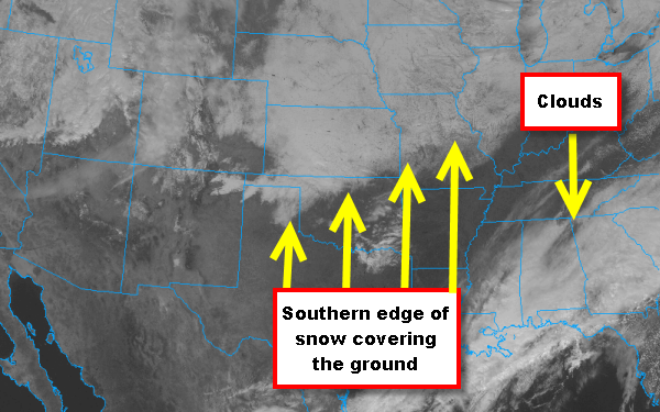
The winter storm that affected the Plains and the Midwest this week, left quite the mark on the country. Snow fall blanketed many location and many areas received over a foot of snow. This afternoon the snow is showing up on the visible satellite image. Across the Southeast a stalled front is allowing for continued cloud development and that is all the white showing up from Mississippi east through the Carolinas . Back in the Plains and Midwest, you will notice most of that region is covered in white as well. That is not cloud cover, this is the reflection of the sunlight off the snow on the ground in that region. You can even see the individual rivers in Iowa and Nebraska as little winding dark lines. This is very common to see in the winter time and you can see the snow capped mountains back into the Rockies as well. The darker areas across much of Texas, Arkansas and into Kentucky are where skies are clear and there is no snow on the ground.