


New data is rolling into the office tonight. A few notes…
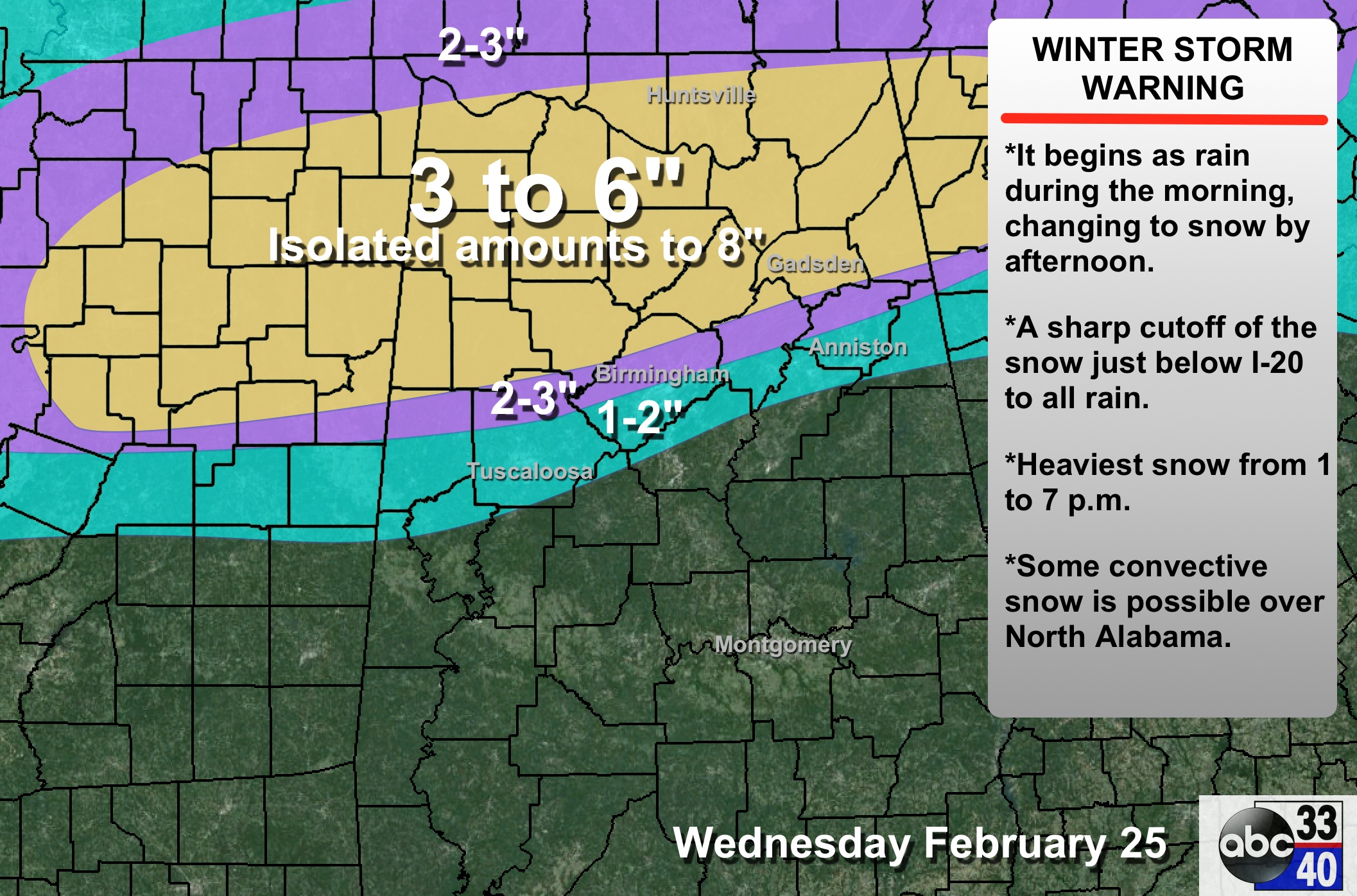
*We have forecast this, but we want to stress it looks like the precipitation will begin for many in the form of rain tomorrow morning, with a quick change over to snow where thermal profiles are cold enough tomorrow afternoon.
*The window for the heaviest snow is between 1:00 and 7:00 p.m.
*The biggest forecast issue continues to be the rain-show line. The 00Z NAM suggests it will be very close to I-20. It could be a day when Warrior gets 5 inches of snow, and Calera has a cold rain. Same thing over in Tuscaloosa County; those that live around Lake Tuscaloosa could get 2 inches of snow, but those down in Duncanville get just rain. Defining this is still very problematic tonight. I get the idea snow amounts across the Birmingham metro will vary widely.
*Potential for 3 to 6 inches of heavy, wet snow continues over North Alabama tomorrow afternoon and tomorrow night; isolated amounts to 8 inches. Confidence in this is high.
*There will be a tight gradient on the southern edge of the snow. We will probably go from 5 inches to nothing in only 25-30 miles. And, that gradient won’t be along a nice line we draw on a map.
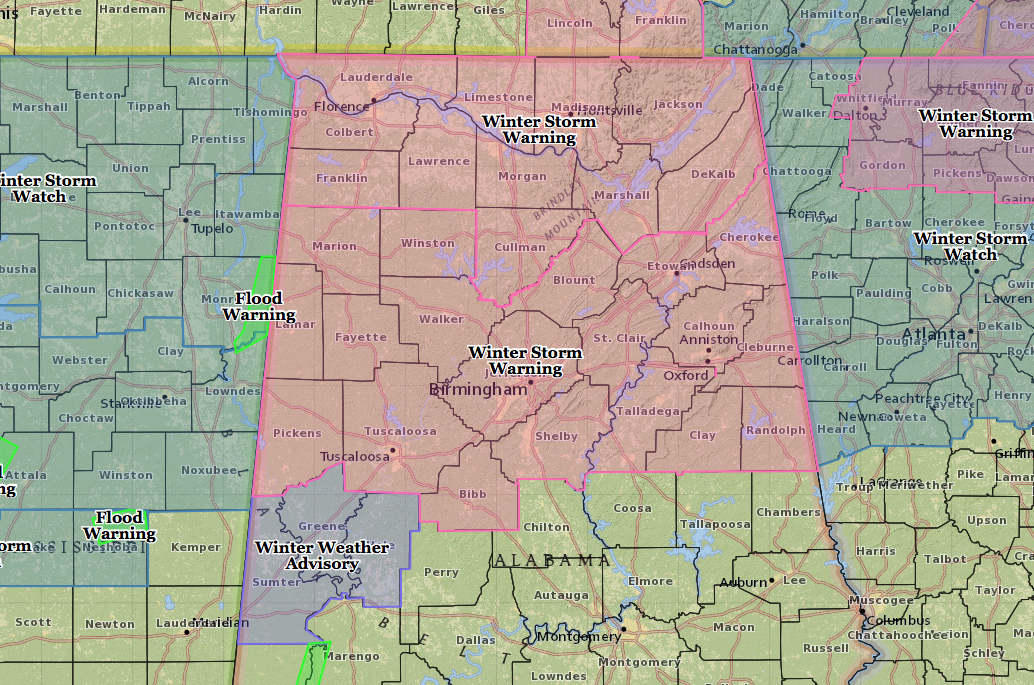
*No changes in the winter storm warning from the NWS…
Made some small adjustments to the forecast; and as we have stated for days, the forecast can, and will change again.
DON’T FORGET: Some snow lovers will be delighted with the amount of snow they see tomorrow, others severely disappointed. That is just the way it is.
Look for a full discussion and Weather Xtreme video very early tomorrow morning….



