


7:56 PM WATCH UPDATE
The tornado watch has been canceled for Fayette, Pickens, Walker and Winston Counties.
The tornado watch continues for Bibb, Blount, Calhoun, Cherokee, Chilton, Etowah, Greene, Hale, Jefferson, Marengo, Perry, Shelby, St. Clair, Sumter, Talladega and Tuscaloosa Counties 10:00 PM CDT.

ORIGINAL POST
Showers and storms continue across Central and North Alabama this evening, but they are not severe.
The severe threat has not materialized so far because the warm front is having trouble lifting away from the Gulf Coast. While we are not out of the woods yet, it has been just general thunderstorms and rain so far this evening.
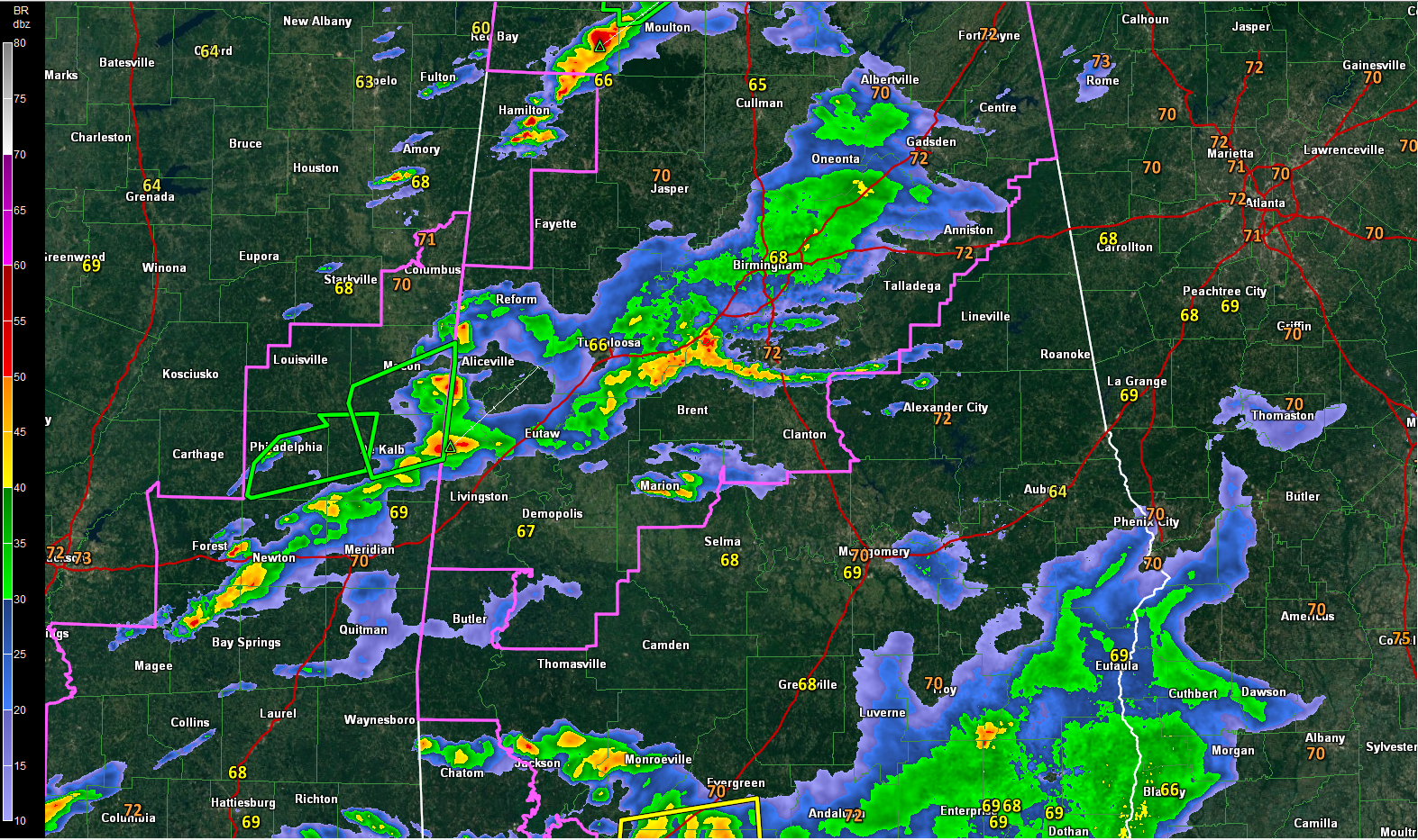
The heaviest precipitation with some lightning and thunder is over Pickens, Sumter, Greene, southern Tuscaloosa and Bibb Counties.
The storm near Carrollton is one of the strongest and will bring heavy rain, frequent lightning and winds that could gust to 50 mph to parts of Lamar, Fayette and Pickens Counties. Areas from Pickensville to Reform will be most affected.
A fairly strong storm was over Kemper County MS southeast of DeKalb. It will move northeast into northern Sumter and Greene Counties.
Moderate rain with some embedded thunder covers much of Jefferson County.
In Northwest Alabama, heavier showers are over northern Marion and southern Franklin Counties.
Everything is moving northeast.
The environment over Alabama is less unstable tonight so the severe weather threat is marginal. We will be watching for any signs that a storm or two could become severe, but for the most part it will be only lightning, thunder, heavy rain and gusty winds that we will have to worry about.
A tornado watch remains in effect until 10 p.m. for much of Central Alabama. In addition to that, a flash flood watch remains in effect for much of the area as well.
DAMAGE SURVEYS
The NWS Birmingham surveyed the damage in northern Jefferson County and found that the Kimberly Tornado was an EF1 and the Graysville Tornado was an EF2.



