


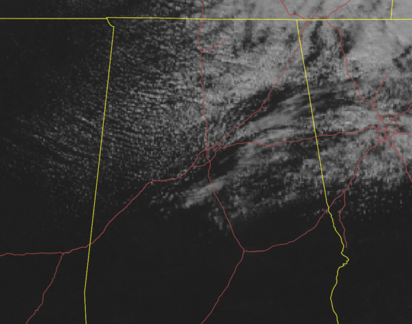
As of 1:00 pm, nearly all of the southern half of Central Alabama is currently basking in complete sunshine while the northern half continues to put up with pesky clouds associated with a clipper system that is in the process of moving through the area. There may be a few sprinkles falling over the eastern parts of the area along and south of I-20 to just north of I-85.
Temparatures were in the 50s to the lower 60s across the area. Haleyville was the cold spot at 50 degrees while Demopolis was the warm spot at 62 degrees. Birmingham was at 55 degrees.
Unfortunately, more clouds will begin to move into the northern parts of the area bringing with them a small chance of isolated showers with an occasional snow flurry or two mixed in later tonight and into the overnight hours. There will be no accumulations in Central Alabama. Before that, skies will be partly cloudy in the north and mostly sunny in the south. Highs will top out in the lower 50s to the lower 60s from north to south. Overnight lows will fall into the mid to upper 30s.
Saturday will be a fantastic day across Central Alabama as we’ll have mainly sunny skies and highs reaching the mid-50s to the lower 60s.
UPDATE ON WEDNESDAY’S STORM THREAT
The European model has really slowed the progression of this system with most of the action now not occurring until Wednesday evening through Thursday afternoon. It has a surface low moving northeast starting from Central Louisiana on Wednesday evening and entering the northwestern parts of Central Alabama just after midday on Thursday. With this trajectory of the low, this may lower our severe weather threat and increase the potential for heavier rain. We will still have the possibility of strong storms with gusty winds, but we could still see a few severe storms capable of producing damaging winds, some small hail, and a brief tornado or two.
The GFS is nearly 18 hours earlier with the arrival of the system with the surface low taking a similar track but just a few miles south of the European track. Pretty much the same story exists with the GFS as it looks to be more of a heavy rain event with the potential of a few stronger to severe storms.
As you can see, we have a big discrepancy in the timing of the event, so we’ll need more time to be able to get better information to make a better forecast. I would tend to side with the European model on this, but let’s say that we could see heavy thunderstorms at times starting as early as Wednesday morning and persisting through Thursday morning, some of those storms may become strong to severe. Isolated damaging winds, some small hail, and a brief tornado can’t be ruled out. We’ll also have to watch for the potential of some flash flooding issues, especially with heavier thunderstorms. We’ll keep you posted.



