


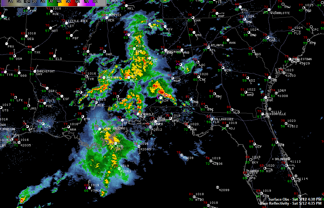
Rain and thunderstorms continue to overspread West Central Alabama at this hour.
The activity is reaching the Tuscaloosa area right now. They are part of a batch of storms that cover parts of Greene, Hale, southwestern Tuscaloosa, much of Pickens and southern Lamar Counties.
Heavy storms are over northern Lamar and western Marion County about to reach Hamilton.
A larger batch of stronger storms extends from Livingston in Sumter County back into eastern Mississippi near Meridian. A flash flood warning was just issued for several counties west of Meridian where 3 to 4 inches of rain has fallen and more rain is on the way.
Still nothing severe and no severe weather is expected. Can’t rule out the need for a warning or two, but so far so good.
There is a slight risk from the SPC over a tiny part of Southwest Alabama that includes Washington County north of Mobile. A tornado warning does continue for Simpson County in SE Mississippi, around Mendenhall.
More storms are forming near the weak surface low which is approaching I-20 west of Vicksburg at this hour.
The rain will arrive in the Birmingham area after 6-7 p.m. It will be the beginning of a wet and sometimes thundery night and Mother’s Day across Central Alabama.



