


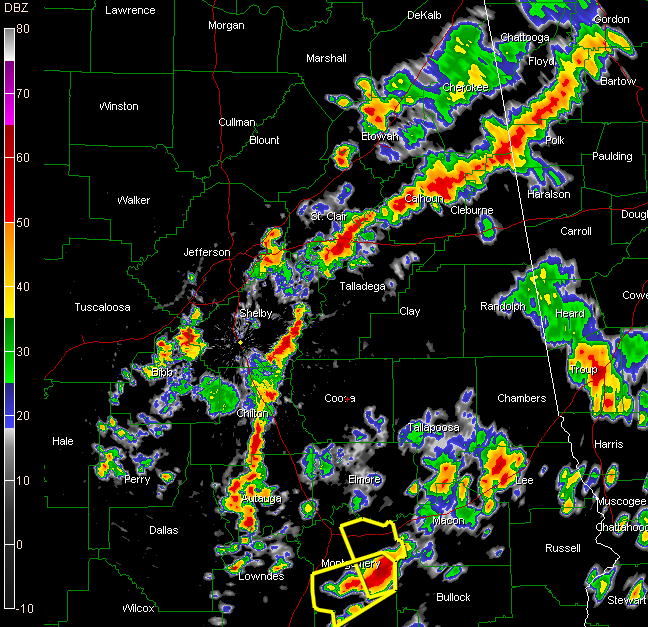
Thunderstorms have been fairly numerous east of I-59 and east of a line from Tuscaloosa to Pine Hill.
Storms are now forming a sort of a line from northern Cleburne and Calhoun Counties through St. Clair, Talladega, eastern Shelby, Chilton and Autuaga Counties.
Others are…
…over eastern Jefferson County
…southwestern Jefferson into Bib and western Shelby Counties
…northwest and southwest of Gadsden
…over western Perry County
…over East Central Alabama over Lee and northern Macon County
…in the Montgomery area where severe thunderstorm warnings are in effect
There have been no reports of wind damage this afternoon. There have been several hail reports…including:
…nickle sized hail at Cedar Bluff in Cherokee County about 3:15
…ping pong ball sized hail in Dadeville at 2:30…at 2:36 half dollar sized hail was reported at Dadeville
…marble sized hail at Bass Pro Shop in Moody about 2:27 p.m.
The lightning is intense. There is a report of a house being struck by lightning at Lay Lake.



