


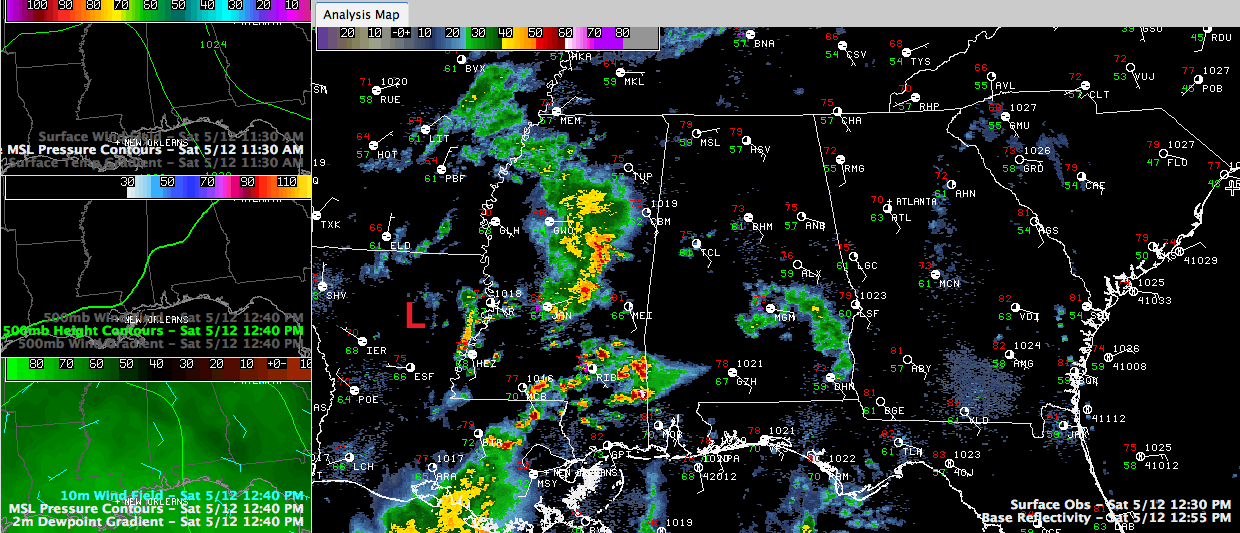
A weak surface low is getting its act together this afternoon over eastern Louisiana just to the west of Vicksburg. It will be an important player in Alabama’s weather over the next 36 hours.
Showers and storms are developing to the east and northeast of the low over Central into southeastern Mississippi. One of these storms is about to enter Washington and northwestern Mobile counties in Southwest Alabama and a tornado warning has been issued by the NWS Mobile for a circulation approaching Citronelle.
These storms seem to give credence to the RPM which shows increasing showers and thunderstorms through the afternoon hours and into the overnight over Alabama.
The storms will begin impacting West central Alabama before midafternoon, but may hold off in the Birmingham area until this evening after 6 or 7 p.m. In fact, it may hold off until 8 or 9. This is important for the various outdoor events going on across the Metro today.
Brian Peters is keeping a close eye on the weather as one of the organizers for the Buck Creek Festival in Helena, and he is confident that the rain will hold off until mid-evening, so head out and enjoy the evening. Can’t have anybody any better doing weather support than the Internationally Beloved Meteorologist!
Any severe weather today and tonight should be limited to southwestern sections of the state, although we can’t rule out a strong to severe storm somewhere across the rest of the state as well.
Look for at least an inch of rain overnight and another inch by tomorrow night.



