



The NWS in Huntsville has issued a severe thunderstorm warning for parts of parts of Jackson County, Alabama up into Franklin County, TN.
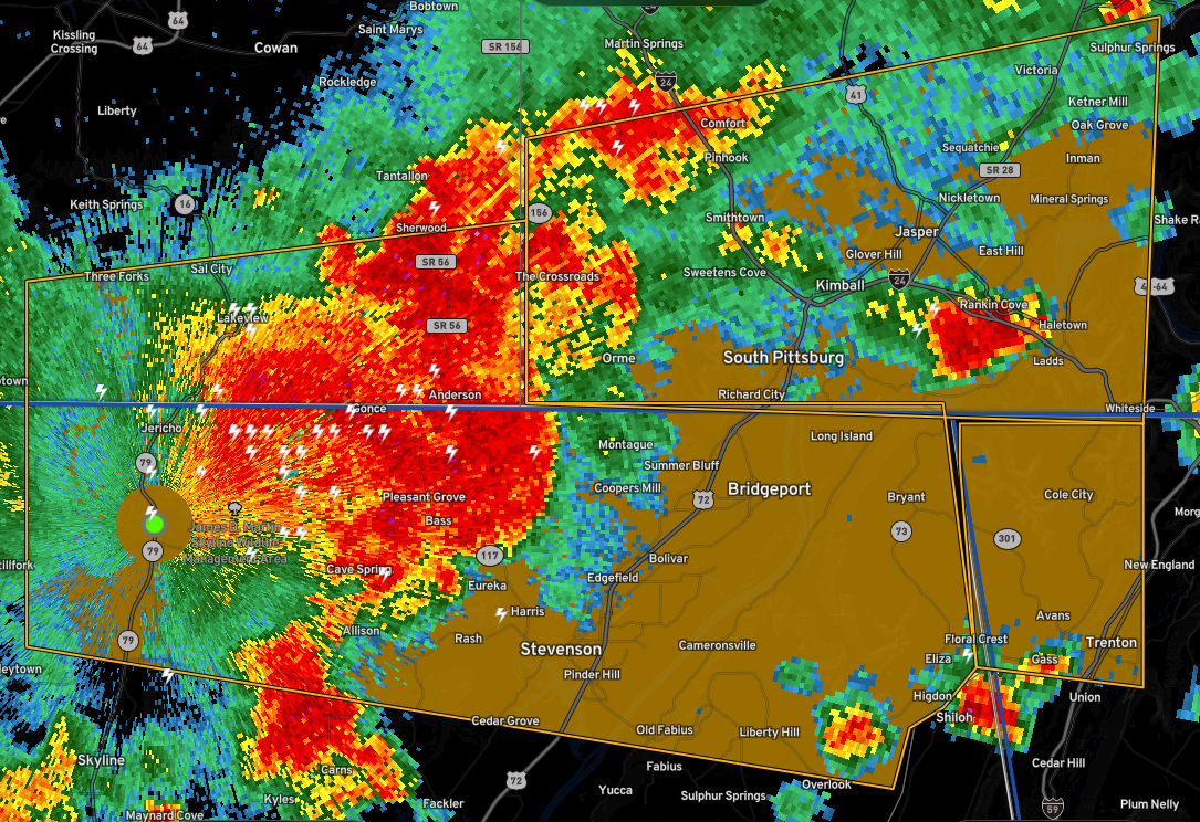
Severe storm near the Hytop radar site will push eastward across the northern parts of Jackson County including Pleasant Grove and Bridgeport.

In northeastern Mississippi, severe storms there have really picked up intensity in the last 30 minutes. They extend from Waterloo in Lauderdale County, Alabama to Iuka, MS to Boonville to Baldwyn, to Blue Springs to Thaxton.
Strongest winds look to be between Tupelo and Guntown according to the NWS Memphis.
These storms are moving east at 35 to 40 mph. On this track, they will approach Colbert County within 15-20 minutes, Franklin County, Alabama by 1:15-1:20 and Marion County, Alabama by 1:45-2 pm.
The storms are building southward and will eventually impact Lamar and Pickens Counties as well it appears.
Storms are now forming over Blount, Marshall, and Etowah Counties in Northeast Alabama. Those storms should intensify as well.
They have extremely unstable air to ingest as they press eastward into Alabama. Today looks even more active that yesterday.



