


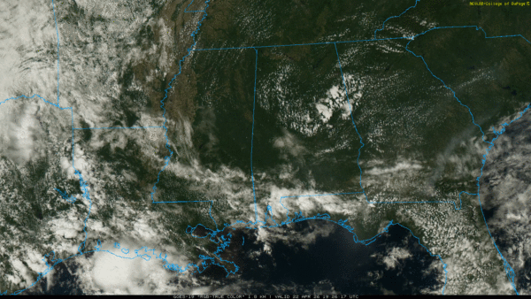
RADAR CHECK: While most of Alabama is simply warm and dry with a good supply of sunshine, we do note a few widely scattered showers over the far southern part of the state. These showers will fade quickly after sunset, otherwise tonight will be mostly fair with a low in the 50s and 60s.
The weather won’t change much tomorrow; just a few isolated showers over the southern quarter of the state. While a few showers are possible over the western half of the state during the day Friday, the next statewide chance of showers and thunderstorms will begin Friday night. We note SPC has defined a low end “marginal risk” of severe thunderstorms for Northwest Alabama Friday night…
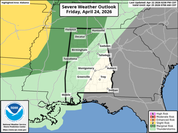
A few storms Friday night could have strong, gusty winds over the northwest part of the state.
THE ALABAMA WEEKEND: We will maintain the a good of showers and storms on Saturday, but at the moment it looks like the highest coverage of rain will come during the morning, with just a few lingering afternoon showers. The sky will be mostly cloudy with a high in the low 80s.
And, Sunday continues to look relatively dry with just a few isolated showers, mainly over the southern half of the state. Sunday’s high will be in the low to mid 80s with the potential for some sun at times.
NEXT WEEK: A rather unstable airmass will be in place across the Deep South for most of the week, and the pattern looks unsettled. There will be multiple days with a risk of showers and storms, but nailing down the specifics is challenging at this point. SPC has pulled back on Monday’s severe weather risk, with a smaller part of Northwest Alabama defined.
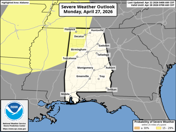
The reliable European global model keeps most of the rain and storms on Monday west of Alabama… suggesting the day here will be mostly dry. Storms move in late Monday night and Tuesday morning; it remains to be seen if we have a severe threat on Tuesday. We could very well have another risk of strong to severe thunderstorms later in the week… see the video briefing for maps, graphics, and more details.
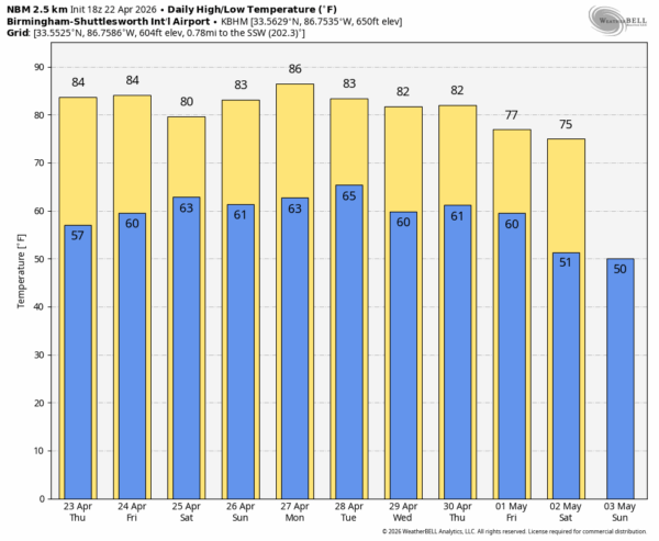
RACE WEEKEND: Friday looks warm and dry in Talladega with a high in the low to mid 80s. Showers and storms are likely Friday night into Saturday morning; a decent part of Saturday afternoon looks dry although a few spotty showers are possible. And, on Sunday, the weather looks good for the Jack Link’s 500 with just a small risk of a shower during the afternoon. Afternoon highs will be stay in the 80-84 degree range over the weekend.
ON THIS DATE IN 1912: A violent tornado moved through Cordele GA during the early morning hours. The tornado cut a path through the heart of the town, destroying hundreds of homes and businesses. Many of the structures were “swept away”. In Cordele alone, at least 21 people were killed, and scores more were injured. The total death toll for Georgia that morning reached approximately 28.
ON THIS DATE IN 1984: At least three tornadoes touched down in Alabama, including an F2 at Brent/Centreville, where one home was demolished. Several buildings sustained roof and window damage.
Look for the next video briefing here by 6:00 a.m. tomorrow…



