


The SPC is growing more concerned about storms over Central Louisiana and how they will act as they move northeast into Mississippi and eventually West Central Alabama in the wake of the initial line.
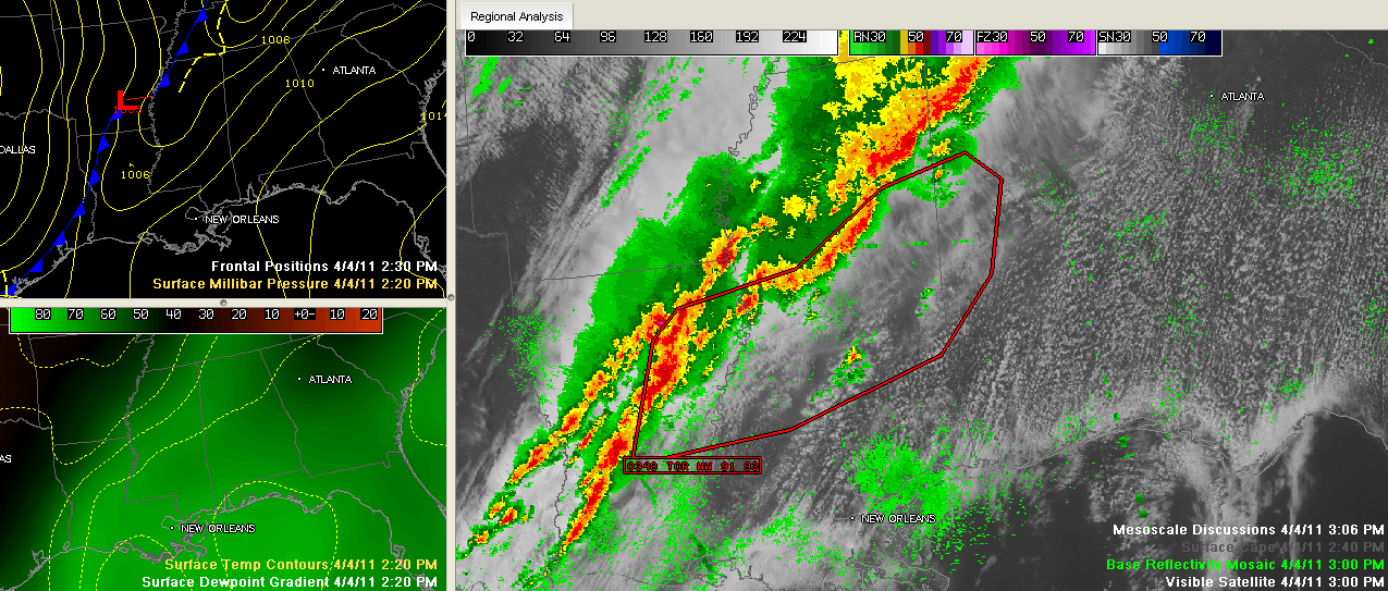
Here is a graphic showing the area of a new Mesoscale Discussion from the SPC in red in the right panel, along with the current radar.
The top left panel shows the surface chart, with isobars in yellow and fronts in blue with the low pressure center over southeastern Arkansas.
The lower left panel shows dewpoint gradient in green with temperature contours in yellow.
Click to expand.
Here is the text of the MCD:
MESOSCALE DISCUSSION 0348
NWS STORM PREDICTION CENTER NORMAN OK
0252 PM CDT MON APR 04 2011
AREAS AFFECTED…LA…MS…NRN AL
CONCERNING…TORNADO WATCH 91…93…
VALID 041952Z – 042145Z
THE SEVERE WEATHER THREAT FOR TORNADO WATCH 91…93…CONTINUES.
18 SOUNDINGS SHOW RELATIVELY STRONG INSTABILITY IN PLACE FROM LA
INTO MS WITH MUCAPE AROUND 3000 J/KG. ALSO DEPICTED IN THE SOUNDINGS
WAS RELATIVELY STEEP LAPSE RATES PROFILES ALOFT WHICH SHOULD LEAD TO
ROBUST UPDRAFTS.
EARLIER STORMS THAT MOVED ACROSS NRN MS AND INTO TN HAVE LEFT A
TRAILING OUTFLOW BOUNDARY OVER NRN AND CNTRL MS…TRAILING SWWD TO
THE COLD FRONT OVER NRN LA. RECENTLY…STORMS OVER NRN LA HAVE
BECOME INTENSE SUPERCELLS WITH INDICATIONS OF TORNADOES.
AS THESE STORMS CONTINUE NEWD OVER NERN LA AND CNTRL MS…THERE WILL
BE A THREAT OF TORNADOES…DAMAGING WINDS AND HAIL. A FAVORED ZONE
FOR ENHANCED LOW LEVEL SHEAR AND TORNADIC POTENTIAL WILL BE ALONG
THE OUTFLOW BOUNDARY.
ALSO NOTED IN THE MIDDAY SOUNDINGS AND VWPS WAS A MID LEVEL BACKING
OF THE WINDS. THIS MAY DISRUPT TORNADO/SUPERCELL POTENTIAL SOMEWHAT
DUE TO STORM MODE…BUT EVEN WITH A MORE LINEAR
STRUCTURE…PARTICULARLY DAMAGING WINDS MAY OCCUR ALONG WITH
EMBEDDED AREAS OF ROTATION.
Here is a tornado warning from the NWS Jackson…
Tornado Warning for Catahoula, Franklin [LA] till 4:00 PM CDT …AT 308 PM CDT…LOCAL LAW ENFORCEMENT REPORTED A TORNADO. THIS TORNADO WAS LOCATED NEAR ROSEFIELD MOVING NORTHEAST AT 55 MPH.
Radar:
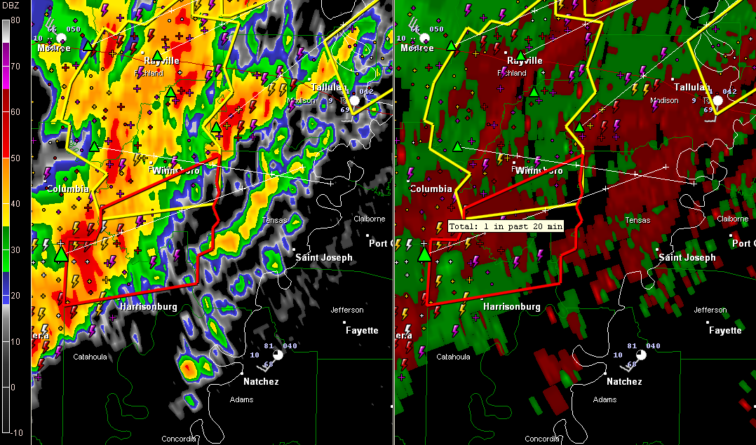
The tornado will pass a few miles north of Natchez.



