


We were sitting in our office in Trussville working away when there was a rumbling sound outside. This was followed by a second loud rumble. Someone said, “Was that thunder?” Nah. Couldn’t be. I had just looked at the radar and there was nothing there. I was contemplating a blog post entitled, “Storms to the left, storms to the right,” with a thought toward Jimmy Buffet as I looked at the showers and storms heading toward Northwest Alabama and the ones over northwestern Georgia.
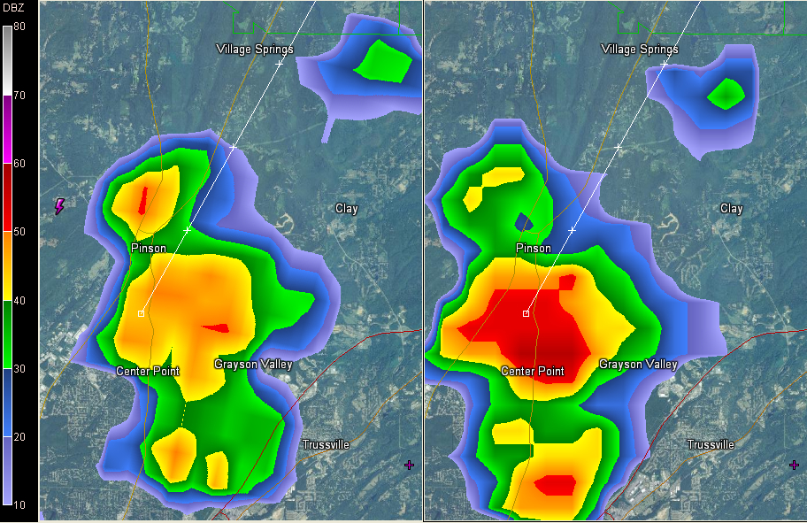
But sure enough, a cell had blown up right to our northwest over the Center Point area. It has a good bit of lightning in it and there is already quite a bit of precipitation suspended aloft. Look for heavy rain, gusty winds and frequent lightning as it moves northeast toward Grayson Valley and Clay. It is passing near Pinson as well.
The image shows the base reflectivity on the left and composite reflectivity on the right (a composite of all the tilts of the radar in one picture).
It is part of a zone of showers that are trying to develop from about the Birmingham Metro northeast into northwestern Georgia. Ryan will have a mesoscale update shortly as well.
It sort of tells the tale of what we are going to experience for the next couple of days: rounds of showers and storms at just about anytime.



