


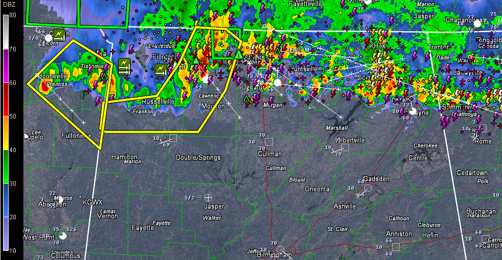
There appears to be a little kink in the warm frontal boundary over North Alabama tonight.
To the west of the kink, a flanking line of storms is shifting more to the southeast.
A new severe thunderstorm warning was just issued for Colbert, Franklin, Lauderdale, Lawrence, Limestone [AL] till 12:45 AM CDT. Numerous trees are reported down near Iuka MS. There is even an entrapment according to media reports. There is wind damage being reported in the Sheffield area as well.
Storms could enter Marion and Winston Counties in the next 15-30 minutes. The NWS Birmingham is choosing to go Significant Weather Advisory for now on these storms.
The storms may get into Cullman County before 1 a.m.
Areas from Marshall into Etowah and northern Calhoun Counties will experience the storms that edge a little further to the south over the next few hours.
For now, it appears the storms may stay north of the Birmingham/Tuscaloosa areas. But we will be watching.



