


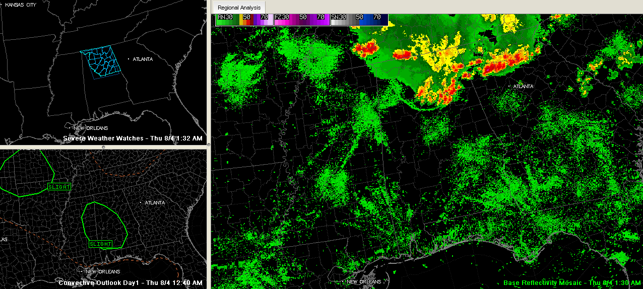
Our southward moving storms are weakening tonight…having just given one last collective burst of outflow winds that is preceding them southward.
The dying storms extend on an arc from Breman to The Colon to north of Trafford to Allgood to Springville to Ragland to Glencoe, Hokes Bluff and Cedar Bluff.
The strongest remaining storms are over St. Clair, Etowah and DeKalb Counties, but all warnings have expired or have been canceled.
There is still a good bit of lightning up around Gadsden and some in Cullman County as well as some up around Fort Payne, but it is going downhill.
To the northwest, more storms over western Tennessee will affect Northwest Alabama shortly and could hold together down into West Central Alabama, but the warnings associated with them have been dropped.
The outflow boundary will push a little further south and southwest…eventually running out of steam, but acting as a focus later today for thunderstorm development. The SPC has parts of eastern Mississippi and western and South Central Alabama outlooked in a slight risk for severe weather today.
We’ll call for a pretty good chance of storms developing during the day today. Highs will still be well into the 90s across much of the area though, with some 100s over West Central Alabama.



