


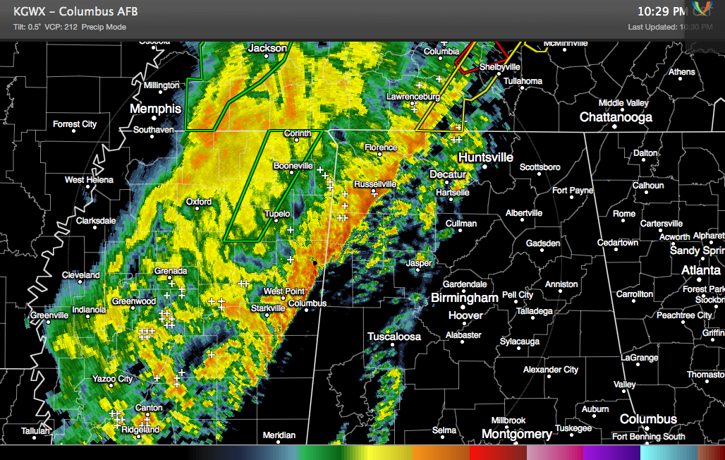
The line of thunderstorms over northwestern Alabama and eastern Mississippi has slowed its further progress and weakened tonight as the upper level dynamics associated with the system lift out across the Ohio Valley.
The line of storms is now over northwestern Marion County. It is about to enter northwestern Lamar County.
It is expected to continue slowly weakening across Central Alabama through the overnight hours. The storms may re-intensify Sunday afternoon over southeastern sections of the area.
Tornado watch continues until 2 a.m
We will continue to monitor the storms through the enter night and will have frequent updates and the latest from the affected areas.
Rain and storms may linger a good bit of the day across Middle Alabama. Putting the morning forecast together.



