


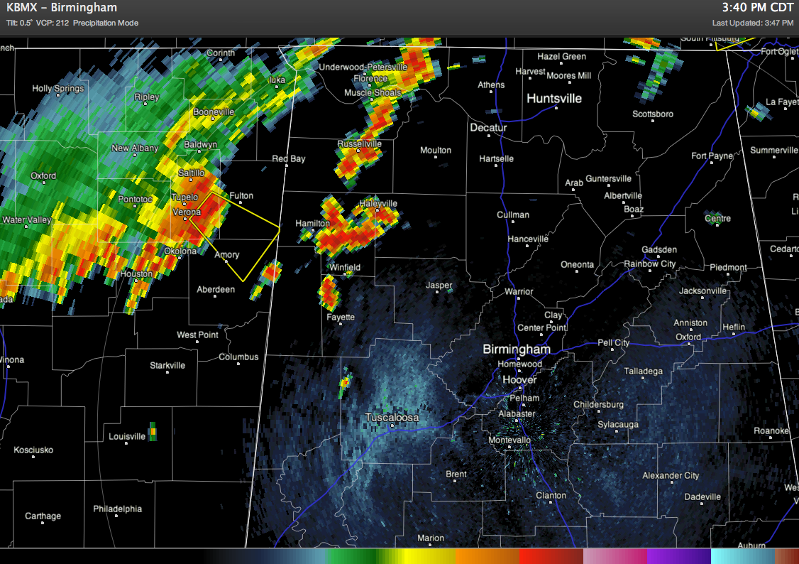
It has taken a while, but a number of scattered heavy storms have fired up in Marion, Winston, and Fayette Counties; there is also an intense line of storms that just came through Tupelo, Mississppi which is moving southeast toward western Alabama. Some of these storms will have the potential for hail, gusty winds, and tremendous lightning output. At this moment, a Severe Thunderstorm Warning is in effect for Monroe, Itawamba, and Lee Counties in East Mississippi.
The RPM (model) is one of my favorite tools to use when trying to forecast storms like this. They are not part of a major storm system, and that means they are really just taking advantage of all this hot, humid air at the surface for their survival. Complexes of storms often change the environment around them by enhancing the wind fields in the nearby atmosphere; that helps the whole complex propagate in a particular direction. The original storms die out while new ones develop in the same area; that gives it the look of one solid line of storms that lasts for hours. Here’s the latest RPM output for the storms entering northwestern Alabama right now:
Notice how it did not pick up on the strong storms near Guin and Winfield at the time the radar image above was taken? This is why models are limited to “general ideas.” Thunderstorms are smaller than the data grid used by forecast models like the RPM, NAM, GFS, and so on, so it knows there should be some in the area, but it cannot pick out a particular spot for an individual storm!
So, the RPM says it will be raining heavily around Jefferson, Walker, and Cullman Counties by 7:00 PM. Let’s see how it does with the accuracy this evening!
-Jason
Twitter: @simpson3340
Facebook: Jason Michael Simpson



