


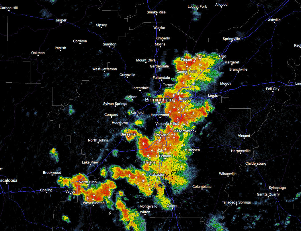
Strong thunderstorms are moving through the eastern parts of Jefferson and the western parts of Shelby County, and is now invading the Birmingham Metropolitan Area. This cluster of storms is moving to the southwest at around 10 MPH, and the main threat will be from gusty winds up to 50 MPH and some pea size hail.
Cells are merging near US 280 which may lead to a temporary strengthening as those approach Hoover and Pelham. Lightning is really starting to increase very close to those areas.
There is very heavy rain falling from Pinson to Alabaster, along with plenty of dangerous cloud-to-ground lightning. You need to get indoors quickly if you are in these locations: Birmingham, Hoover, Vestavia Hills, Bessemer, Homewood, Pelham, Mountain Brook, Helena, Irondale, Leeds, Fairfield, Fultondale, Tarrant, Midfield, Brighton, Indian Springs Village, Lipscomb, Birmingham Fairgounds, Shops of Grand River and Five Points South.
We’ll keep an eye on this cluster of storms ad there is a possibility of it intensifying further.



