


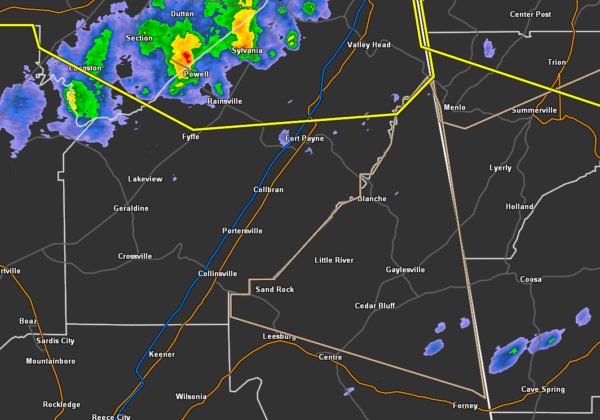
…SIGNIFICANT WEATHER ADVISORY FOR CENTRAL CHEROKEE COUNTY UNTIL 700
PM CDT…
At 611 PM CDT, Doppler radar was tracking strong thunderstorms along
a line extending from near Trenton to near Sylvania to 7 miles
northwest of Geraldine. Movement was southeast at 55 mph.
Winds in excess of 40 mph will be possible with these storms.
Locations impacted include…
Centre, Cedar Bluff, Centre Municipal Airport, Little River Canyon
National Preserve, Leesburg, Sand Rock, Gaylesville, Cornwall Furnace
Park, Western Weiss Lake, Blanche, Eastern Weiss Lake, Little River
Falls, Fullerton, New Moon, Yellow Creek Falls, Chesnut Bay Resort,
Broomtown, Howells Crossroads, Waterhouse and Chesterfield.
PRECAUTIONARY/PREPAREDNESS ACTIONS…
To report severe weather, contact your nearest law enforcement
agency. They will relay your report to the National Weather Service
office in Birmingham.



