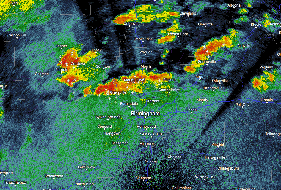
At 9:53 PM CDT, Doppler radar was tracking strong thunderstorms along a line extending from Gorgas to Pinson. Movement was northeast at 15 mph. Dime size hail and winds 30 to 40 mph will be possible with these storms.
A SIGNIFICANT WEATHER ADVISORY has been issued for Southeastern Walker, Southern Blount, and Northern Jefferson counties until 10:30PM CDT.
Locations impacted include…
Birmingham, Trussville, Jasper, Gardendale, Fultondale, Oneonta, Sumiton, Cordova, Dora, Pinson-Clay-chalkv, Dallas, Center Point, Clay, Pinson, Tarrant, Adamsville, Warrior, Kimberly, Graysville and Morris.