


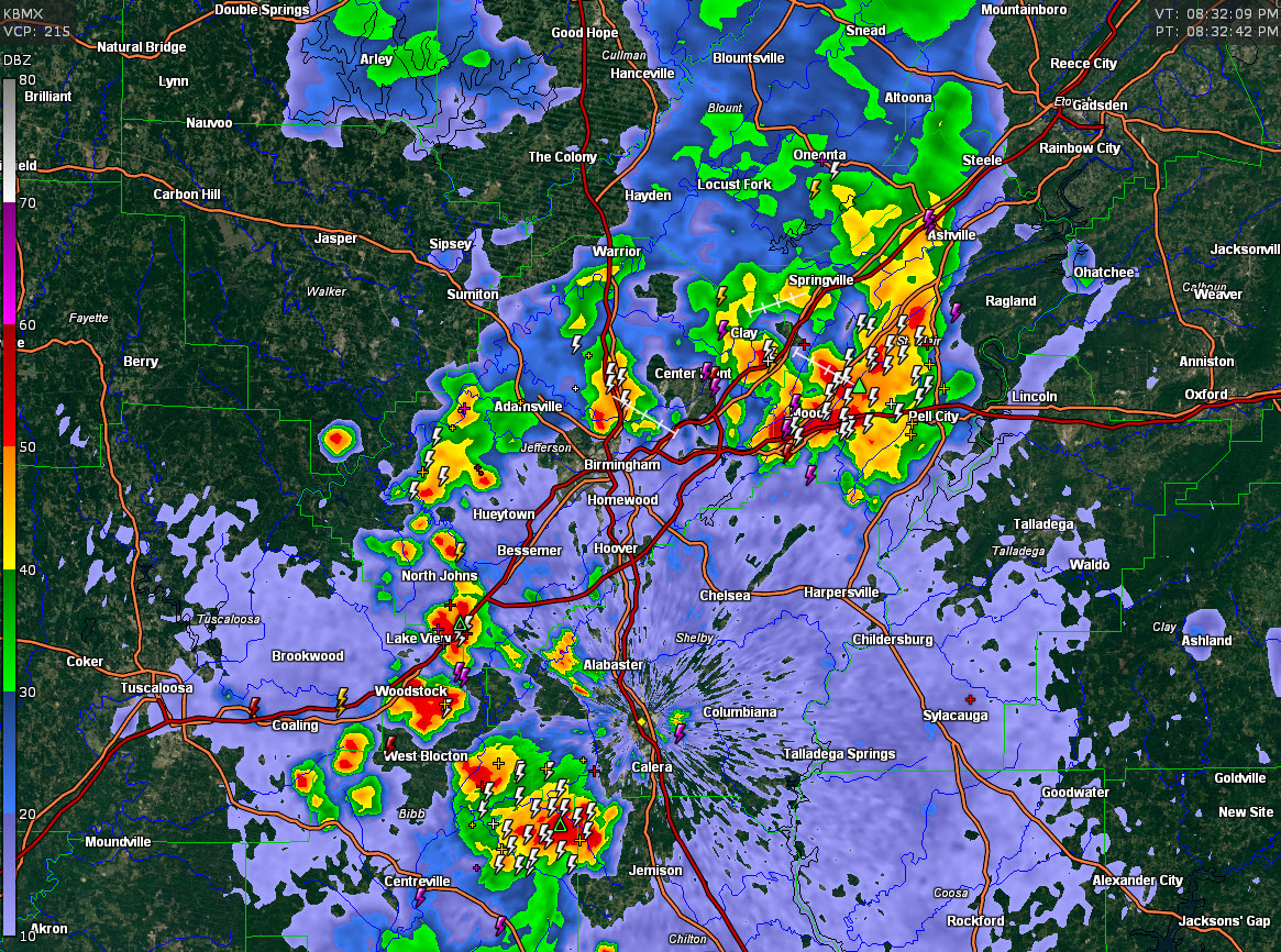
Strong storms continue this evening across parts of the Birmingham Metro Area.
The majority of them are lined up just north of I-20 from western Jefferson County through Fultondale to near Argo to the Moody, Odenville and Pell City.
They contain a good bit of lightning, heavy rain, and gusty winds.
The NWS Birmingham has issued a Flood Advisory for parts of Blount, Etowah, and St. Clair Counties.
To the southwest, strong storms are affecting areas from Tannehill State Park to southeast of Woodstock to eastern Bibb County, southwestern Shelby, and North Central Chilton County.
They also contain a good bit of lightning, heavy rain, and gusty winds.
Elsewhere, to the west, strong storms over eastern Mississippi may drop into parts of Pickens and Sumter Counties over the next hour or so. A severe thunderstorm warning is in effect for parts of Noxubee, Kemper and Winston counties.
Storms have weakened over southwestern parts of central Alabama, including parts of Greene, Hale, Marengo, and Perry Counties. A flash flood warning is in effect for parts of those counties where moderate rain continues. Over four inches of rain has fallen in areas near Thomaston in Marengo County.
All of the storms will slowly go downhill overnight as we gradually lose instability.



