


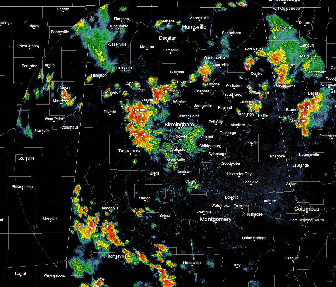
A cluster of strong storms continue to move westward into locations west of I-65 as of 5:05 PM, some of which are causing some minor flooding issues. The heaviest thunderstorm was located in the northeastern parts of Tuscaloosa County that has the possibility of dropping up to 2.00 inches over the next hour, especially for Lake View, Brookwood, Vance, Mercedes Benz Of Alabama, Abernant, North Bibb, Caffee Junction, East Brookwood, I-20 Rest Area Near Tuscaloosa and Cedar Cove.
More strong storms are located just to the north and northeast of the Tuscaloosa County storms up in the southwestern parts of Walker County, up in the northeastern parts of Walker County and into the southwestern parts of Cullman County, and back up in the northern parts of Blount County. All of these storms have significant weather advisories issued on them. Strong gusty winds, dangerous cloud-to-ground lightning, and very heavy rainfall can be expected with these storms as they continue to move west and southwestward at 10-15 MPH.
A Flash Flood Warning continues in effect for parts of Jefferson County until 6:00 PM this evening.
More strong storms are located in the southwestern parts of the area down in Sumter and Marengo counties. These are moving northeast and could possibly interact with the storms in Tuscaloosa and Walker counties before the end of this evening. We’ll continue to watch to see if this happens.



