


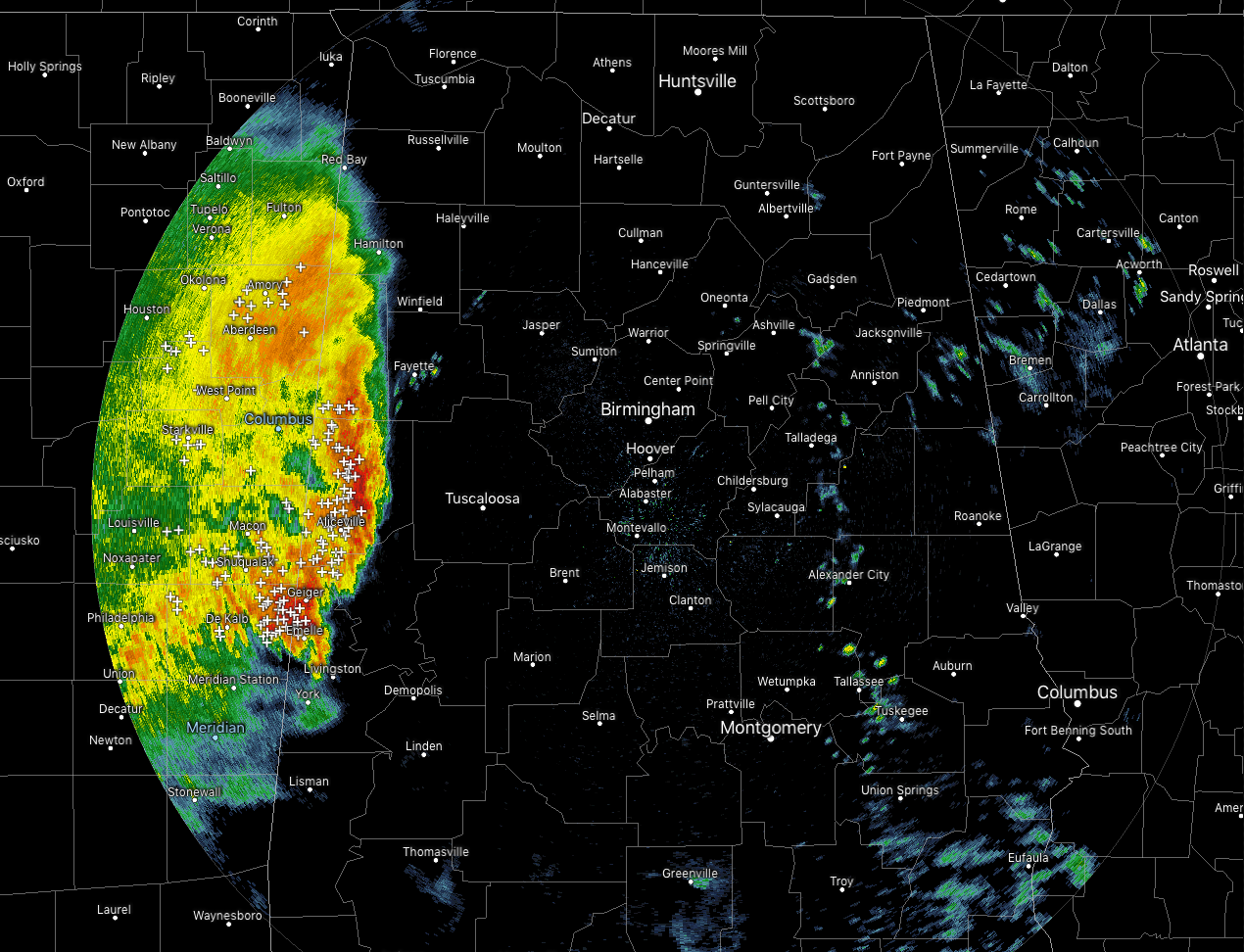
Strong storms continue to move into the western parts of Central Alabama as of 10:00 am this morning, but the good news is that there are no active severe warnings in the area. At this point, instability and helicity values are too low to be supportive of severe thunderstorms across Central Alabama, but it doesn’t take that much instability to keep thunderstorms going.
Strong storms are now pushing into the western parts of Fayette County and will be entering the western parts of Tuscaloosa County soon. Heavy rain, gusty winds, and dangerous cloud-to-ground lightning can be expected as these storms continue to move eastward.
Neither the NAM-3k or the HRRR picked up on these storms moving in this early as they were painting activity not moving into the state until around the 12:00-1:00 pm time frame. They are both showing that the main activity will move through and behind the main line, more scattered showers and storms will be possible through the latter part of the day and into the nighttime.
 hours.
SPC continues a Marginal Risk for severe storms for locations south of a line from roughly Tuscaloosa to Tuskegee, with the southern parts of Marengo County included with much of South Alabama in a Slight Risk. Damaging winds up to 60 MPH will be possible over those risk areas. The risk of a brief tornado is not zero but is very, very low at this point.
According to how much activity develops and moves over the Gulf Coast will determine how much stronger storm activity we’ll see up into Central Alabama. The more activity over the coast, the less energy will make it up into our area. Timing for stronger to severe storms in the southern parts will be from around 12:00 pm to roughly 8:00 pm from west to east.
We’ll keep you posted throughout the day.



