


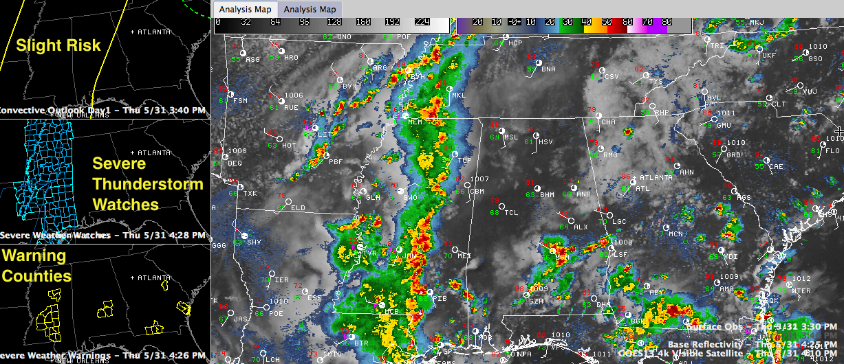
First, we have some strong storms over South Central Alabama between Montgomery and Greenville in the increasingly unstable air where the sun has been out and southerly winds ahead of a surface low are pumping deeper moisture northward. Their formation is also being aided by an old mesoscale convective system that is pushing across South Alabama. A severe thunderstorm warning is in effect for Montgomery/Lowndes Counties. Another now includes Montgomery and Elmore Counties. The strongest part of that storm will cross Downtown Montgomery at rush hour. It may produce 60 mph+ winds.
To the west, strong storms are pushing across Central Mississippi. They extend from near Oxford in northern Mississippi to near Ackerman to near Carthage. These storms are now 2 1/2 hours of Lamar and Pickens Counties and less than 3 hours from Sumter County in West Alabama. Severe thunderstorm warnings are in effect along this line. These will continue to maintain their intensity or even intensify as they push toward Alabama. This is because they are moving into increasingly unstable air where the sun has been out for the past couple of hours.
The good news is that the potential for tornadoes is very, very low. Cant rule one out, but there is just not much low level wind shear.
There is just enough overall shear for the storms to remain organized, and they have pretty good potential to produce damaging winds and decent potential to produce large hail. There have been several reports of wind damage in Mississippi, mainly downed trees. Winds gusted to 55-60 mph in Madison. Hail has been mainly pea to dime size. Several reports of half inch hail from the Memphis area. The SPC has a 30% probability that there will be damaging winds within 25 miles of points in West Central Alabama. There is a 15% probability of large hail. 30% is pretty high for a damaging wind threat and 15% is elevated from the standard risk. The SPC maintains a slight risk from areas west of a line from Heflin to Rockford to Atmore.
The line of storms will push across Alabama tonight between 6 p.m. and 2 a.m.
They should reach the Birmingham area around 9 p.m. Although our dewpoints are low right now, I think they will come up as a warm front lifts northeastward ahead of the strengthening surface low over southeastern Missouri and western Tennessee. This should help the storms maintain their intensity as they move into North Central Alabama. They could begin to weaken as they push into East Alabama later this evening, but that will remain to be seen.
Pay close attention to the weather through the evening and into the overnight hours across Central Alabama. The severe thunderstorm watches will likely be extended east into Alabama and there will undoubtedly be several severe thunderstorm warnings.



