


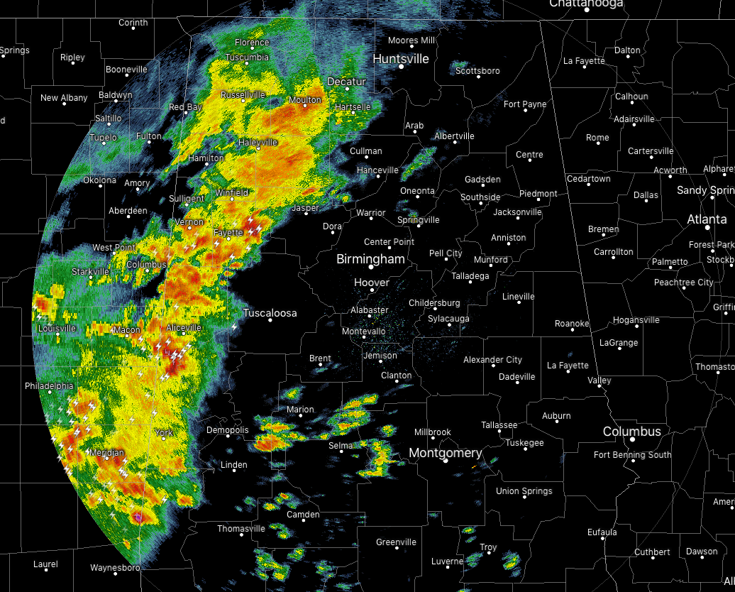
As of 10:15 am CST, we have a line of showers and thunderstorms pushing across the western portions of North and Central Alabama. Some of these storms are packing a little bit of a punch with gusty winds up to 40 MPH and some pea-size hail. Along with those threats, we also have very heavy rainfall and dangerous cloud-to-ground lightning occurring. All of the activity is moving to the east at 30 MPH.
We currently have two Significant Weather Advisories on two cells… one for parts of Greene, Pickens, and Sumter counties until 10:45 am, and the other is for parts of Fayette and Walker counties until 10:45.
The larger cities to be affected by the line of storms within the next 60-90 minutes will be Cullman, Jasper, Tuscaloosa, Dempolis, and all points in between… and as possibly as far east as Oneonta, Birmingham, Brent, and Marion.
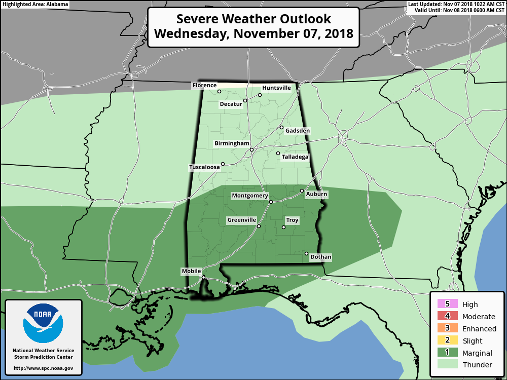
The latest Day 1 Severe Weather Outlook was just released by the SPC and it shows a Marginal Risk for severe storms over the southern parts of Central Alabama… mainly along and south of a line from Cuba to Greensboro to Waverly. Isolated damaging wind gusts will be the main threat as the Marginal Risk area is for storms that are developing along a warm front that is moving northward.
If any severe weather breaks out in Central Alabama, we’ll have warnings posted on the blog as soon as they are issued.



