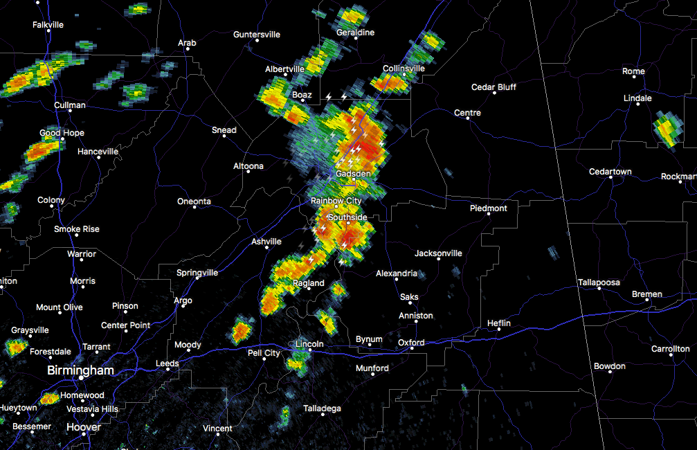
At 11:22 AM CDT, Doppler radar was tracking strong thunderstorms along a line extending from near Tabor Road to near Ohatchee. Movement was east at 25 mph. Winds in excess of 40 mph will be possible with these storms. A wind gust to 37 mph was recent measured at the Gadsden Airport.
Locations impacted include…
Jacksonville, Piedmont, Centre, Cedar Bluff, Little River Canyon National Preserve, Forney, Centre Municipal Airport, Glencoe, Ohatchee, Leesburg, Sand Rock, Gaylesville, Tennala, Cherokee Rock Village, Pleasant Gap, Cornwall Furnace Park, Blanche, Jacksonville State University, Slackland and Weiss Lake.
Torrential rainfall is also occurring with these storms, and may lead to localized flooding. Do not drive your vehicle through flooded roadways.
Frequent cloud to ground lightning is occurring with these storms. Lightning can strike 10 miles away from a thunderstorm. Seek a safe shelter inside a building or vehicle.