


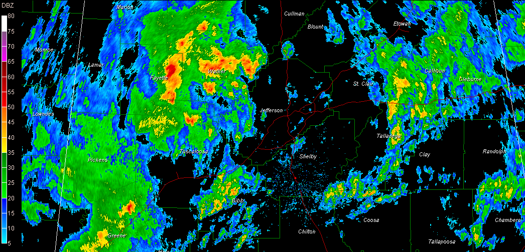
Strong storms continue in a cluster over West Alabama this morning, covering much of Fayette, southern Walker and extreme northern Tuscaloosa Counties. It is storming in places like Kennedy, Belk, Fayette, Newtonville, Berry, Moores Bridge, Oakman, Parish and Carbon Hill. You’re starting to hear thunder in Jasper. Heavy rain, gusty winds to 40 mph, lightning and loud thunder will continue to accompany the storms.
They will be affecting Cullman County over the next hour as well.
A tornado watch is in effect for West Alabama until 10 a.m. We could see a couple of tornadoes as we go through the morning hours, but for now, these West Alabama storms are not surface based. This means the instability that is driving them is up off the surface a few thousand feet. This make them less likely to produce tornadoes.
Warm, moist air covers Alabama this morning thanks to low pressure centers to our west and northwest and a strong low level flow that has been in place off the GUlf of Mexico since the weekend. Temperatures are in the upper 60s to near 70F over West Alabama, with middle 60s in East Alabama. Dewpoints are in the middle and even upper 60s across Central Alabama, quite juicy for November.
There is some instability over West Alabama where most unstable CAPE values are running around 500 j/kg in spots. Lifted indices are barely negative, except from about Birmingham down to Marion where they are running -1 to -3.
BMX sent up a balloon at midnight and found some instability above the surface with stable air near the surface. But more unstable air over Mississippi will push into Alabama this morning and storms will become more surface based. These are more likely to produce tornadoes. Winds were increasing just off the surface over Mississippi and this area will be expanding into Alabama this morning. This shear is more conducive for tornadoes as well.
But I stress that this is a MARGINAL severe weather event. Can’t rule out a tornado or two in this situation, hence the tornado watch. As James has said, this is nothing like April 27th.
Three tornado warnings in southern Mississippi as I write this at 3:35.



