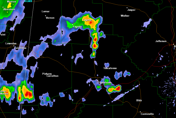
A few storms have developed over West Alabama this morning. These storms are currently affecting areas around Fayette, Samantha, Vance, Duncanville and Cochrane. Watch out around portions of Highways 43, 69, 82, 11 and Interstate 20/59. Storms could be impacting Tuscaloosa and even into portions of western Jefferson County soon. The most intense thunderstorm is in southeast Tuscaloosa County and is moving towards portions of Bibb County. All activity will continue to push off to the east-southeast today and most everyone should see some showers and storms today. With such an unstable atmosphere in place, storms could reach severe limits and be capable of producing large hail, damaging winds, frequent and dangerous lightning as well as torrential rain.