


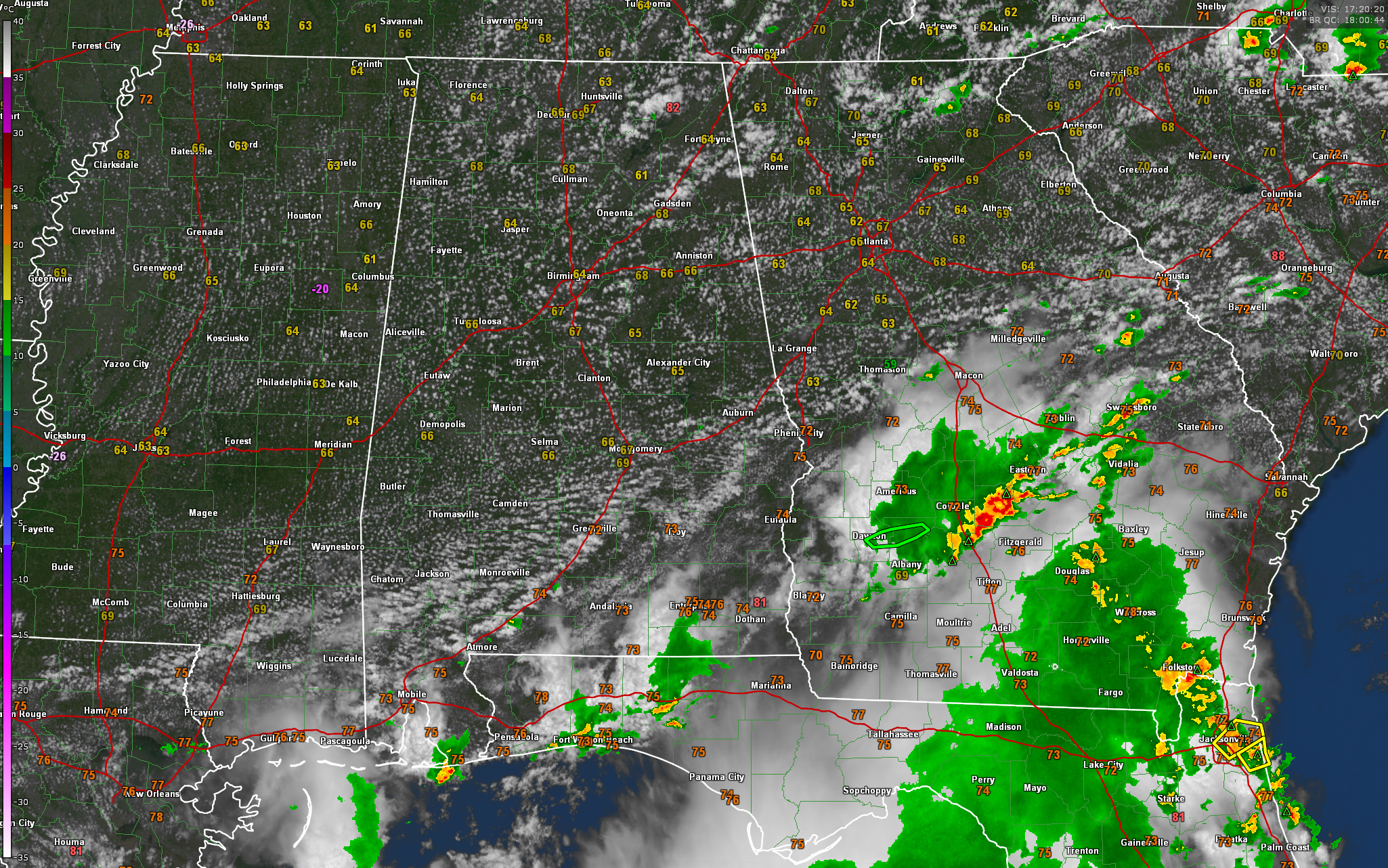
Showers and storms continue across Southeast Alabama, Northwest Florida and southern Georgia near a stationary front that lies across that area. There have been severe thunderstorm warnings in North Florida and there is currently a flash flood warning in areas north of Albany GA.
Across North and Central Alabama, skies are partly cloudy. Some cooler temperatures aloft have given the sky a post frontal spring look, with some cumulus and stratocumulus.
And temperatures are cooler and dewpoints lower behind the front. Dewpoints over the northern half of the state are in the 60s, with more tropical 70s down near the front.
North and Central Alabama should be dry today with highs in the 80s. Lows tonight over the northern two-thirds of the state will be downright comfortable, rangingin between 64-68F. Some of the normally cooler spots in North Alabama may drop into the lower 60s, or maybe we will even see a 58 or 59 degree reading! There will be some patchy fog, especially near bodies of water, where water temperatures will be warmer than the air temperatures!
Tomorrow will be hotter, under partly cloudy skies and dry conditions. Highs on Monday will be in the upper 80s Tennessee Valley, with lower 90s elsewhere.
Tuesday, Wednesday, and Thursday will be hot, and showers and thunderstorms will be hard to find. Afternoon highs will be in the middle 90s and overnight lows will be in the middle 70s.
Isolated to scattered thunderstorms will return Friday into the weekend.
In the tropics, Don was downgraded to a tropical storm this morning after briefly becoming our first hurricane of the season yesterday. It is turning into the westerlies over the North Atlantic and will become post-tropical by early Monday. The NHC has downgraded its outlook for the wave about 850 miles east of the islands. It puts the chance at about 40 percent that it could become a depression. Even if it does, it will get shredded apart by strong wind shear over the Caribbean.
A strong tropical wave will be moving off the African coast late Monday into Tuesday and this one does have some potential to develop. The GFS does have it becoming a tropical depression by late in the week over the Main Development Region of the Atlantic and approaching the Leewards by Monday the 31st and Tuesday the 2nd as a strong tropical storm. After that, it could be a threat to the Southeast Coast, perhaps the North Carolina Outer Banks. Initial looks don’t suggest Gulf Storm, even if it forms at all. Two weeks out, in full Voodoo territory at this point.



