


Scattered showers and storms formed across Alabama on Saturday afternoon, aided by a boundary pushing in from the east that is associated with a trough of low pressure. The storms were heavy rain producers, but for the most part didn’t cause any problems. The National Weather Service in Huntsville issued a couple of flash flood warnings during the late evening hours. No significant reports of flooding were received.
BIG-PICTURE SETUP
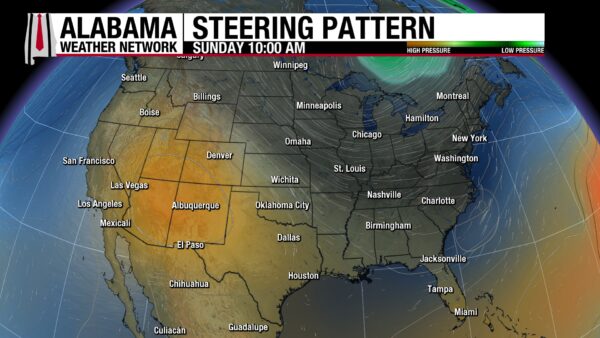
A weak upper trough parked over Georgia and the southern Appalachians is sliding east while a subtle east-to-west boundary noses into east-central Alabama. Farther upstream, a deeper trough digs into the Great Lakes and Ohio/Tennessee Valleys. That larger wave will shove a cold front south through Alabama tonight, replacing our muggy air with a much drier continental airmass. The result: one more day with scattered storms (favored east and south), then a refreshing, late-August “false fall” to start the new week.
YOUR SUNDAY IN ALABAMA
Expect a mixed sky with morning low clouds or patchy fog in spots, then scattered showers and thunderstorms bubbling up late morning through afternoon, most numerous east of I-65 and toward the Wiregrass and coastal counties. Storms won’t be severe, but with very moist profiles and weak steering flow, a few cells can dump heavy rain in a short time and cause localized ponding. Coverage thins with westward and northward extent. Highs range from mid 80s in the east/northeast where clouds and rain linger to upper 80s and near 90 across central and southwest Alabama; a light northerly drift inland and a gentle sea-breeze near the coast.
SIDEWALK FORECAST
For the final day of the Sidewalk Film Festival in Birmingham today, expect a warm, partly sunny backdrop with just enough humidity to make it feel close to 90° at times (actual highs around 86–88°) and a light northeast breeze. A few hit-or-miss showers or thunderstorms could pop between mid-afternoon and early evening—about a 30% chance—so outdoor queues and street venues should plan for a brief downpour and lightning delay window roughly 2–7 PM. Coverage won’t be widespread and activity fades quickly toward sunset, so the late-day and evening screenings look mostly dry and noticeably more comfortable as drier air begins to edge in. Keep water handy, grab a little shade where you can, and have a quick rain plan—then enjoy the films.
FALSE FALL ARRIVES (MON–TUE)
The front slides through Sunday night into Monday, drying the state from northwest to southeast. Monday trends mainly dry with lower humidity arriving; Tuesday is the sweet spot: dewpoints fall into the 50s north (60s south/coast), sunshine dominates, and highs hold in the upper 70s to lower 80s across north Alabama, low–mid 80s central, and mid–upper 80s near the beaches. Nights turn pleasantly cool—upper 50s in some north Alabama valleys, low–mid 60s central, upper 60s coast. A light north to northwest breeze adds to the crisp feel.
MIDWEEK REINFORCEMENT (WED–THU)
A secondary, mostly dry front drifts south midweek, refreshing the air again. Rain chances are negligible statewide, skies stay mostly sunny, and humidity remains in check. Look for highs centered in the mid 80s (around 80–83° in higher terrain), with comfortable mornings—upper 50s north and 60s elsewhere.
LATE WEEK & WEEKEND OUTLOOK
By Friday into next weekend, surface high pressure slips east, allowing a light onshore flow to return. That will slowly nudge moisture back, bringing back isolated to widely scattered afternoon/evening showers and storms—favoring the coastal plain and the southern half of the state—while the north stays largely rain-free. Temperatures remain seasonable: afternoons in the mid to upper 80s (near 90 right at the beaches at times) and mornings from upper 50s north to upper 60s along the coast. Overall: a much more comfortable stretch, with just a modest uptick in coastal showers late in the week.
VOODOO TERRITORY
Here’s how the “voodoo” (week-two) window is shaping up. Guidance keeps a broad ridge parked out West with a corresponding trough over the eastern U.S., which favors periodic north/northwest flow into Alabama. In plain terms, that pattern usually delivers a couple of reinforcing fronts, lower humidity shots, and temps a notch below late-August/early-September normals—think many afternoons topping out in the low to mid-80s north/central with upper-80s closer to the Coast, and nights that can dip into the 60s away from the Gulf. With the mean trough overhead, we’ll still see scattered shower/storm opportunities on some days, especially where boundaries and the sea breeze interact, but it doesn’t scream all-day washouts. Expect the wetter corridors to lean south of I-20 and toward the coastal counties when a front stalls near the Gulf, then a drier, more comfortable feel behind each push.
Out west in the Gulf, ensembles continue to hint at a weak, fast-moving tropical disturbance sliding toward the western Gulf and into northeastern Mexico south of Brownsville. If that plays out, Alabama’s direct impacts look minimal: the deepest tropical moisture and any gusty winds stay far to our southwest. Our main “downstream” effects would be subtle—perhaps a slight uptick in swell/rip-current risk along Alabama beaches and, depending on how the ridge/trough align, a thin ribbon of midlevel moisture that could juice sea-breeze showers along the coast for a day or two. Confidence is decent on the big-picture pattern (cooler-than-normal lean, periodic fronts), but low on day-to-day shower coverage and any fringe influence from that western Gulf system. Net-net: a pleasantly tame early-September vibe for much of Alabama, punctuated by a couple of showery days—more so south—rather than a sustained soaking.
NATIONAL HIGHLIGHTS
A busy national map for your Sunday: a fall-flavored cold front will slide from the Great Lakes into the Appalachians and Tennessee Valley, sparking scattered showers and a few thunderstorms while ushering in a cooler, drier air mass that expands across the East this week (many spots from the Great Lakes to the Northeast dip into the 40s/50s at night). Along the Southeast coast, a developing coastal low rides north and throws bands of rain onshore from Georgia into the Carolinas, with more locally heavy totals near the beaches (Charleston SC broke records on Friday), while the stalled Gulf/Southeast boundary keeps daily downpours going along the shoreline. Out West, the monsoon remains the headline—slow, heavy rain producing storms from Arizona and New Mexico into Utah/Colorado (and west Kansas by Sunday) that can produce flash flooding in canyons, dry washes, and burn scars, plus gusty outflows and frequent lightning. The heat remains dangerous in the Desert Southwest through Sunday, then the core shifts into the Pacific Northwest early next week before easing midweek; meanwhile, the Northern Plains enjoy cooler, sunnier conditions that preview the broader early-week cool-down east of the Rockies.
DANCING WITH THE STATS
4.1 inches of rain in Charleston, SC – Downtown on Friday was a record for the date. They broke their same record on Saturday with another 3.02 inches. Charleston’s record rainfall was the result of a tropical-style setup rather than a single pop-up storm. A stationary front parked over (and just south of) the area acted as a train track for waves of low pressure, while a mid-level trough overhead and extremely juicy air (PWATs 2–2.5″) primed the atmosphere for slow-moving, training downpours. That combo wrung out torrents over the metro, boosting flash-flood risk before activity eased inland late evening and refocused along the coast/offshore overnight. The stalled boundary keeps periods of heavy showers and storms in the mix through Sunday; a stronger cold front arrives Monday to sweep in drier, more stable air and a midweek break from flooding concerns.
TROPICS
Erin is gone, and attention shifts to Fernand and Bermuda. Tropical Storm Fernand formed Saturday afternoon from AL90 a few hundred miles south-southeast of Bermuda after Hurricane Hunters found a closed center (pressure ~1010 mb) and tropical-storm-force winds near 35 kt (40 mph). Fernand is moving due north around 13 kt and should arc north-northeast, then accelerate to the northeast over the next 2–3 days on the west side of the subtropical ridge—keeping the center well east of Bermuda and over open Atlantic waters. With roughly 48 hours over warm water and generally light shear, gradual strengthening is likely despite some mid-level dry air; guidance peaks Fernand as a strong tropical storm and a few members flirt with Category 1, while the official forecast stays just shy of hurricane strength. After Monday, cooler water and increasing shear should weaken the system and drive a transition to post-tropical in about 3–4 days. Bermuda’s main impacts should be limited to rougher seas and occasional swell—no direct land threats expected.
Invest 99L, located east of the Windward Islands, has looked more organized through the day and is flirting with tropical depression strength despite generally unfavorable shear. At a minimum, Barbados, Trinidad & Tobago, and the Windwards should expect squally showers, a few thunderstorms, and gusty winds late Sunday into Monday—below tropical-storm thresholds, but enough for brief disruptions. Beyond that, two reasonable paths exist once 99L reaches the western Caribbean: (1) it stays weak under persistent shear and slides west into Central America, or (2) it survives the shear, finds a more favorable pocket, and strengthens—allowing the mid-latitude trough to tug it north late week toward the central/eastern Gulf or up the U.S. East Coast. Ensemble trends (especially European) have inched toward more development in the western Caribbean, so we’ll keep a close watch and update frequently as confidence improves.
ON THIS DATE IN ALABAMA WEATHER HISTORY
In 2010, Birmingham’s record streak of 90F temperatures finally came to an end after 50 days when the mercury topped out at only 89F. The record streak beat the former streak by nearly two weeks!
WEATHERBRAINS
It’s a double header on this week’s WeatherBrains. At noon, we will have a special show previewing the upcoming special National Weather Association Integrated Warning Team session at the Annual Meeting in Huntsville. Then Monday evening, we will remember the 20th anniversary of Hurricane Katrina.



