


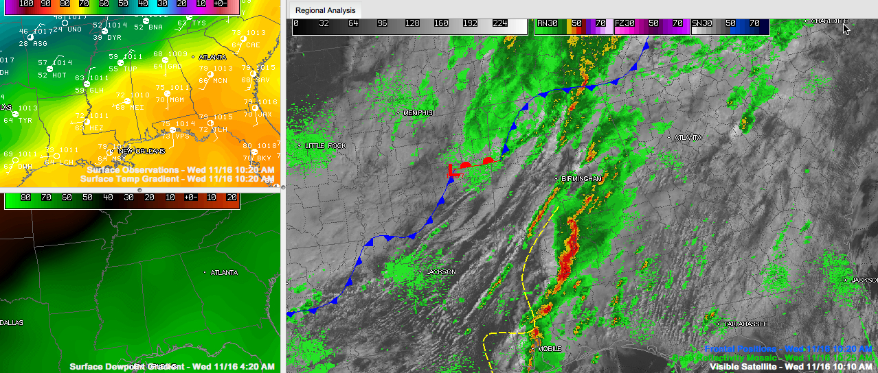
A warm, humid airmass covers the southern two-thirds of Alabama at this hour, south of a frontal system that is draped across the northern part of the state.
A surface low is near Columbus MS. It is responsible for a lot of the tornado mischief this morning, backing the surface winds to the southeast and imparting that extra little spin to the lower levels of the atmosphere. There has been just enough instability to get decent updrafts, and just enough wind shear to sustain them. Throw in that low level spin and you can get some isolated tornadoes.
Temperatures over the Tennessee Valley have fallen into the 50s. There is quite a temperature gradient from 59F at Muscle Shoals to 77F at Tuscaloosa. It is already 54F at Memphis.
We still have a tornado warning in East Alabama for Calhoun County for a storm tracking between Wellington and Weaver and toward Jacksonville. Chris Cheatwood sees a wall cloud just west of Jacksonville State. Everyone at JSU needs to be in tornado shelter. Eventually it will potentially impact Piedmont.
There are also tornado warnings and severe thunderstorm warnings over South Central Alabama including the Montgomery area for a mean looking line of storms that has high potential for wind damage.
There is tremendous rotation near Lowndesboro that will move across the southern side of the City of Montgomery.
The storms will impact Troy University in a little more than an hour.



