


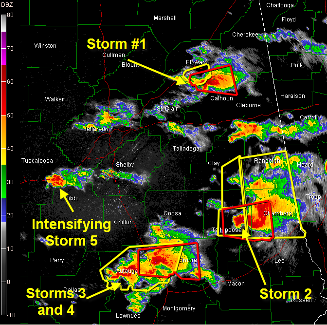
STORM 1
Producing possible tornado between Weillington and Glencoe. Will pass near or just north of Jacksonville. Heavy rain and hail just east of US-431. This storm has weakened a bit, but could recycle back up again.
STORM 2
Dangerous storm between Camp Hill and Lafayette…moving toward Lafayette and Lanett.
STORM 3/4
Tornado Vortex Signature indicated near Millbrook. Will move toward Elmore and Wetumpka. Dangerous storm ramping up near Autaugaville…will move near Prattville.
STORM 5
Dangerous storm with hook and Tornado Vortex Signature just south of Vance. Will pass near West Blocton. This storm could produce a tornado at any time. Folks in Tuscaloosa can see this tower clearly. A severe thunderstorm warning is in effect now for Bibb and Shelby Counties.
NEW TORNADO WATCH
A new tornado watch has been issued for southeastern Arkansas, northeastern Louisiana and much of central Mississippi.



