


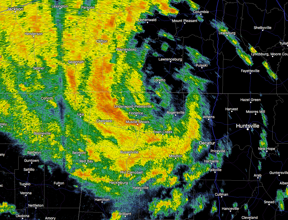
At 4:49 PM, the center of Subtropical Depression Alberto has crossed over the state line into southern Tennessee near the Loretto community in Lawrence County. The heaviest banding of rain and gusty winds is wrapping around from Waterloo to Cherokee to Muscle Shoals and on around to Hillsboro. Estimated rainfall rates from Waterloo to Cherokee are reaching as high as 2.50″ to 3.00″ per hour. A Flash Flood Warning is in effect for parts of Colbert, Franklin, And Lauderdale counties for that very reason. It will expire at 6:00 PM.
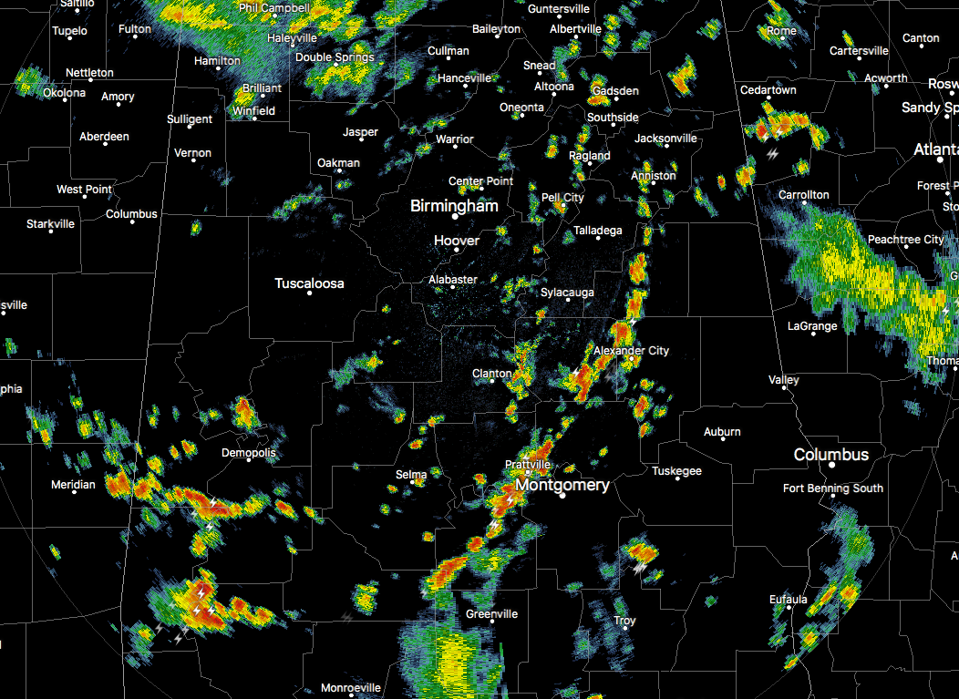
Back to the south over Central Alabama, we have numerous showers and thunderstorms that have developed in this very moist tropical environment that was left behind by Alberto. Several of these in the southern parts of the area currently are strong and have Significant Weather Advisories on them for the threat of gusty winds up to 40 MPH. Dangerous cloud-to-ground lightning and very heavy downpours can be expected with these as they rotate around the tropical low in cyclonic fashion. These cells are moving at roughly 25 MPH.
Most of these scattered storms should dissipate somewhat as we lose the heating of the day after sunset, but a good bit may persist into the late night and overnight hours. The very small tornado threat that existed throughout the day should be coming to an end as the center of Alberto has crossed over into Tennessee, but we’ll continue to watch those northeastern counties for a few more hours.
A Flash Flood Watch continues until 7:00 PM for Autauga, Barbour, Bibb, Blount, Bullock, Calhoun, Chambers, Cherokee, Chilton, Clay, Cleburne, Coosa, Dallas, Elmore, Etowah, Fayette, Jefferson, Lee, Lowndes, Macon, Marion, Montgomery, Perry, Pike, Randolph, Russell, Shelby, St. Clair, Talladega, Tallapoosa, Tuscaloosa, Walker, and Winston counties.
Latest NAM-3k model is showing that we may have some left over scattered tropical showers and storms from the remnants of Alberto, but those will be gone as we reach the late morning hours. The rest of the day dries out and we’ll be left with a slight chance of scattered showers and storms throughout the afternoon and into the evening hours.
Continue to check back with us as the main rain band from Alberto continues to exit the state, and the scattered strong storms continue to pop up in the south.



