


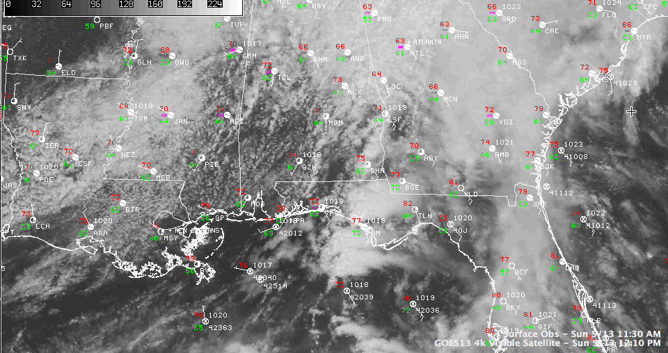
A dry slot has worked northward over much of the southwestern two thirds of the state early this afternoon. It is actually allowing a few peeks of sunshine and has dried up most of the showers.
But the increasing sunshine may actually help to destabilize the atmosphere a bit and may help to fuel the development of more showers through the afternoon hours.
A warm front lies from about Tuscaloosa to Clanton to Wetumpka to Union Springs early on this Mother’s Day afternoon and showers and storms were slowly increasing along it. It is anchored by a weak surface low over Mississippi somewhere around Greenwood. The surface low should drift eastward across the Tennessee Valley this afternoon and tonight.
Scattered showers and storms will be the rule though the afternoon, ending for the most part as the cool front associated with the surface low crosses the area tonight.
Stronger storms should be limited to areas south of I-85. There have been some tornado warnings in the Florida Panhandle northeast of Destin this morning.
Rainfall amounts will average a third of an inch, with lesser amounts to the northwest and slightly higher amounts to the southeast.
There could be a lingering shower or storm tomorrow, and perhaps even one Tuesday, but high pressure should take over by Wednesday, giving us partly cloudy and warmer conditions through the end of the work week.



