


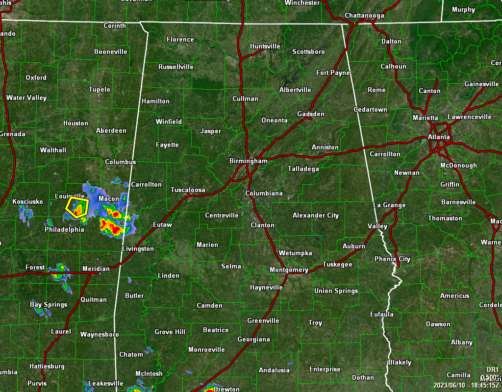
As of 1:45 pm this afternoon, we are seeing showers and storms developing back off to the west in eastern Mississippi, with the eastern edge of that activity stretching over into the western portions of Pickens and Sumter counties. The rest of the area is currently dry with clouds increasing. Temperatures were in the lower 80s to the lower 90s as of the 1 pm roundup. Jasper was the cool spot at 82º. Demopolis, Troy, and Montgomery were all tied as the hot spots at 90º. Birmingham was at 85º.
Rain chances will start increasing as we get later into the afternoon hours, mainly along and west of I-65, while east of that looks to stay dry. Those scattered shower and thunderstorm chances will get higher as you travel west and southwest. Highs will top out in the upper 80s to the lower 90s. Those higher rain chances will spread eastward during the evening and nighttime hours, with rain likely in the west and southwest, and decent chances in the east. Lows in the mid 60s to the lower 70s.
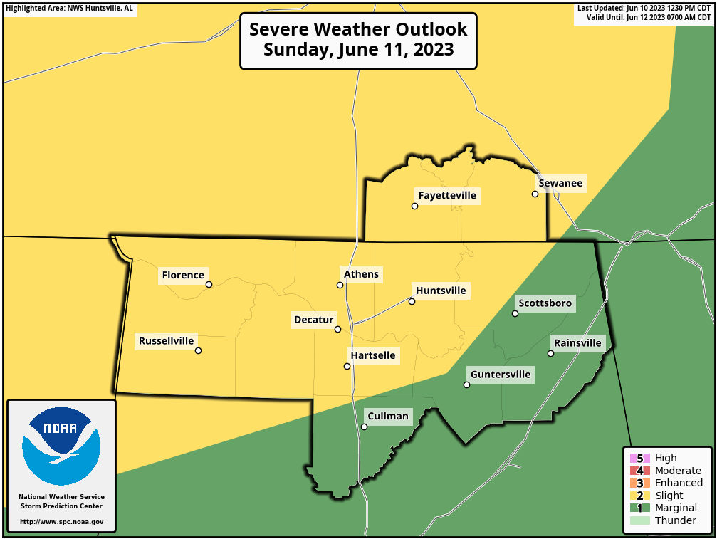
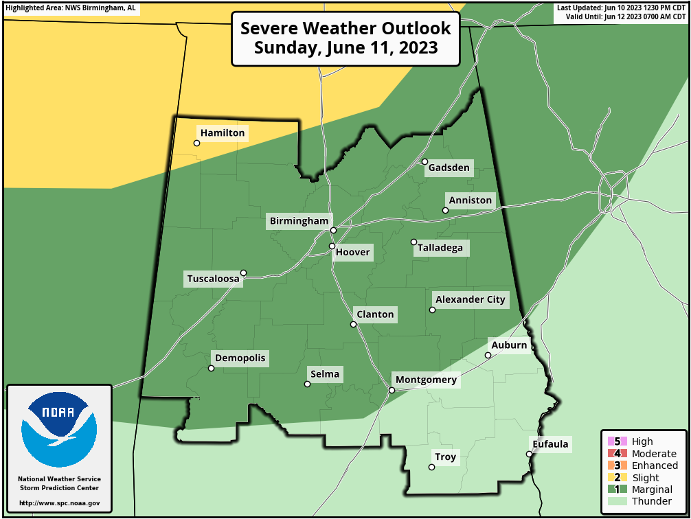
We are still looking at the potential for Strong to severe storms on Sunday, as a shortwave is progged to move into the area. Much of the Tennessee Valley is under a Slight Risk for severe storms, with much of the northern half of Central Alabama in a Marginal Risk. Damaging wind gusts up to 60 mph and large hail will be the main threats, along with plenty of rainfall. While rain is possible at any time, the threat for stronger to severe storms will be during the late afternoon through the late night and into the overnight hours. Highs in the mid 80s to the lower 90s.



