


The morning model data is mostly in and here are the trends…
There is still about an 80-mile spread in the landfall position from west to east, but the most reliable models continue to point toward a landfall between Grand Isle and Morgan City, possibly near Cocodrie in Terrebonne Parish. But we caution not to fixate on one track forecast, because the center could shift 40-50 miles east or west of the official track. That would dramatically alter the impacts for areas along the coast.
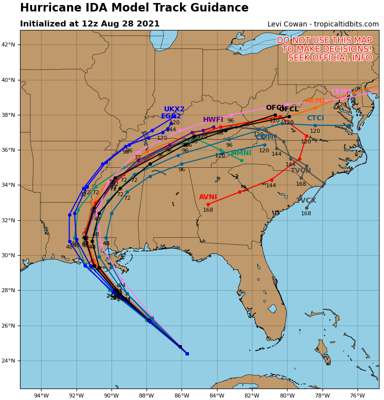
There is still a wide range in the eventual intensity, which is the Million Dollar Question since that will also alter the impacts. For example in New Orleans:
…A landfall west of Houma would produce winds of 50-60 mph with gusts to 65-70 mph.
…A landfall near Grand Isle would produce winds of 100-120 mph with gusts to 145 mph.
That is why it is such a dangerous storm with the impacts hinging on the eventual intensity and exact track. You can’t take chances with this one, and today is the day for finishing preparations and leaving.
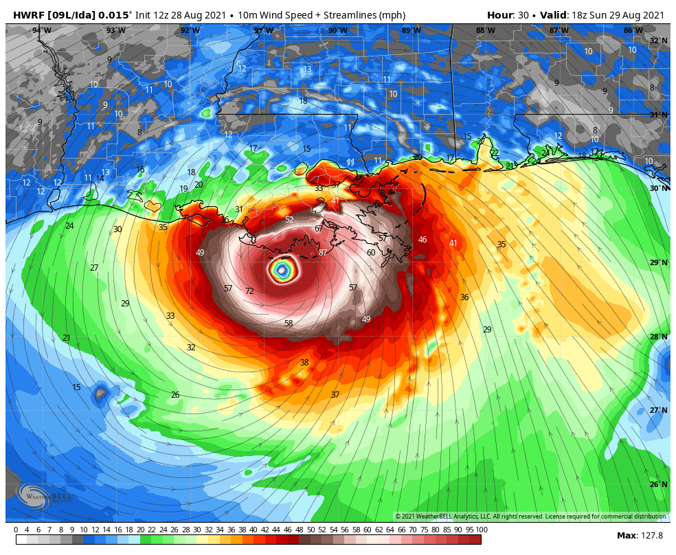
The hurricane models are back on Ida being a 130-145 mph storm before landfall.
Here is the HWRF at 1 p.m. CDT tomorrow with top winds 128 mph:
Here is the HMON, which is even more ominous:
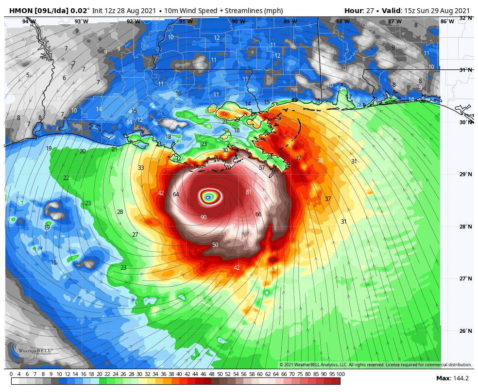
But the HMON thought the hurricane would already be intensifying rapidly. While the storm does look more organized with each passing satellite image, we don’t have a plane in the storm to tell us what is really going on.
The morning run of the GFS is in and it brings the center to just west of Grand Isle as a 110 mph. The hurricane is already nearly that strong according to the NHC which says it is a category two hurricane with winds of 100 mph. Increasing 40 mph in 24 hours is nothing for a storm over Gulf, so the upper-end forecasts are probably where we are headed.
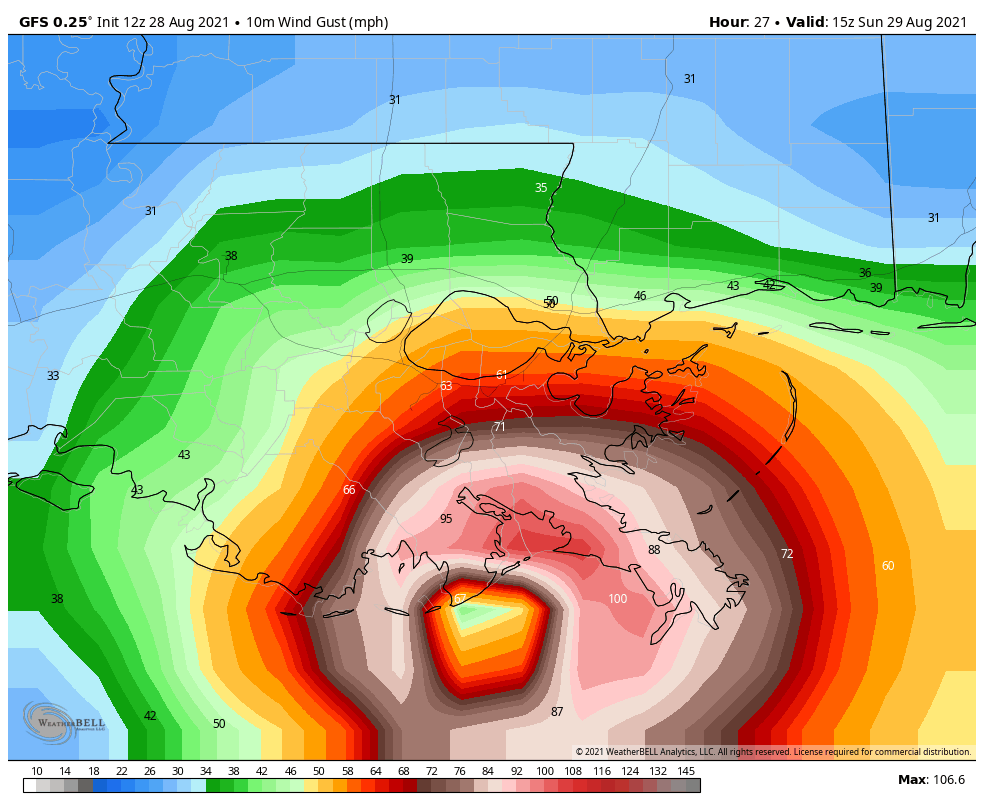
The 1 p.m. Advisory is in, and the center is just a tad right of the forecast track. This raises the potential of the center making landfall just west of Grand Isle.
On its current forecast track, a 60 mile wide area between Morgan City and Grand Isle will see sustained hurricane force winds with a max area of winds between 110-140 mph with gusts to 150-160 mph. Intense devastation would result in those areas. In addition, there will be a devastating 10-15 foot surge all the way into communities like Houma.
We will look at specific impacts including most likely and worst case scenarios shortly, including for us here in Alabama.



