


Fog is very thick in spots across Central Alabama.
The Trussville SKkcam is socked in. Gadsden as well. Visibility at Cullman is 1 mile, 3/4 of a mile at Calera and Albertville. It’s down to 1/2 mile at Alex City. A dense fog advisory is in effect for most of Central Alabama overnight.
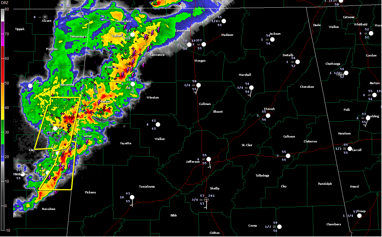
To the west, a line of strong to locally severe thunderstorms extends from east of Florence to Russellville to Hamilton to Columbus MS, then southwestward to near Louisville.
The overall intensity of the line has decreased. The NWS Birmingham has chosen to go with a significant weather alert, not a severe thunderstorm warning, for Marion and Lamar Counties. A severe thunderstorm warning continues for Franklin County til 830 p.m.
Heavy rain and lots of lightning over much of Marion County into Lamar County.
The strongest part of the complex will move into Lamar County shortly.
Winds gusted to 21 mph at Columbus MS as the line passed.
Heavy storms will push into northern Pickens County along US-82 within the next 20 minutes.
The storms will continue to weaken as they push into West Alabama. It is now 50 air miles west of Tuscaloosa, 60 west of Jasper and 80 miles west of Birmingham. They will be significantly weaker by the time they reach Walker and Tuscaloosa Counties, and might not hold together to Birmingham.



