


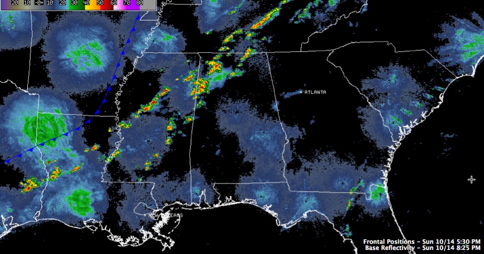
Scattered thunderstorms continue tonight from southern Tennessee into northwestern Alabama and Central Mississippi this evening. The storms have fired ahead of a cold front that is now approaching the Mississippi River.
Instability values are generally 500-1,000 j/kg over the western half of Alabama, decreasing rapidly as you cross east of I-65.
The best low level helicity is already lifting out quickly to the northeast, which is lessening the tornado threat quickly. A brief period of backed (southeasterly) surface winds over Northeast Mississippi and Northwest Alabama raised the tornado threat for a short time.
The storms should continue to the I-59 corridor before 11 p.m. and will push east of there after that. They may actually get a little stronger in the next couple of hours, but the tornado threat is lessening. The storms should weaken after midnight and reach the I-85 corridor by 3-4 a.m.



