


Two scary reports from the NWS Jackson…for storms that are going to affect West Alabama;
s Lamar and marion counties by 3:30 a.m.
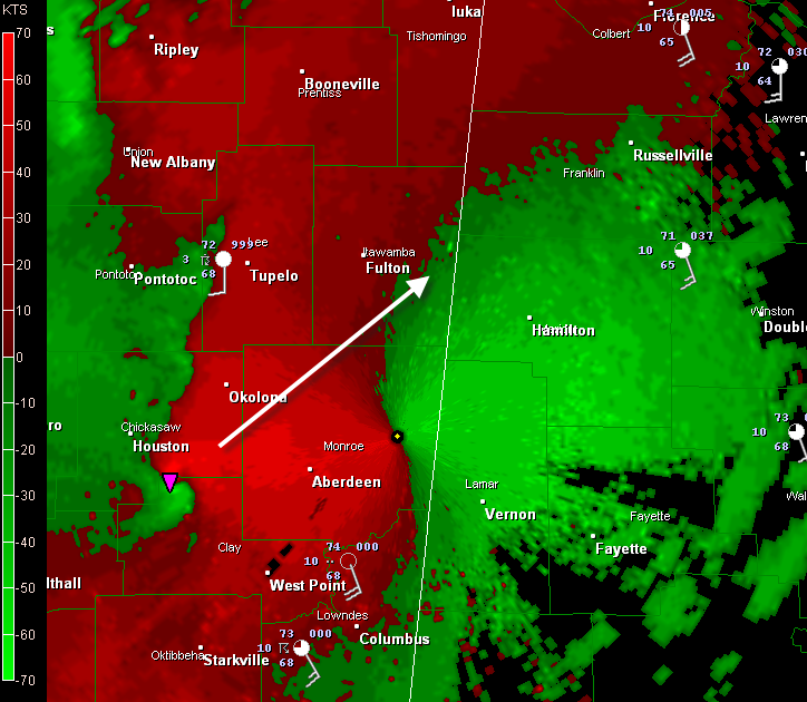
JAN continues Tornado Warning for Clay [MS] till 3:30 AM CDT …AT 255 AM CDT…LOCAL LAW ENFORCEMENT REPORTED A WIDESPREAD DAMAGE FROM A TORNADO IN WEBSTER COUNTY. THIS TORNADO IS NOW LOCATED NEAR MONTPELIER MOVING NORTHEAST AT 60 MPH.
JAN: Mathiston [Webster Co, MS] emergency mngr reports TSTM WND DMG at 02:44 AM CDT — extensive damage reported in the southeast part of webster county. widespread trees and powerlines down…homes and businesses with damage. possible tornado in area based on radar.
Strong rotation is indicated on Doppler radar west of Aberdeen. This will move between Sulligent and Red Bay, probably across western Marion County west of Hamilton in the next 30 minutes.
We need our friends in western Marion and into Franklin County to start taking the actions they need to be safe from a tornado or damaging winds in excess of 60 mph. Please move from trailers to more substantial structures. Don’t be driving when the storms arrive. In homes, he on the lowest floor, center of the house, away from windows.
The NWS Birmingham warns that the Delta V on the story is similar to the Scooba/Geiger tornado on April 15th, measuring 138 knots.



