


The current showers and storms over Alabama will weaken between now and 930 p.m.
But the main event will come later.
Here is a look at the latest output from the HRRR mesoscale model tracking the line of severe storms dropping out of northern Arkansas and western Tennessee. It will reach Northwest Alabama by midnight.
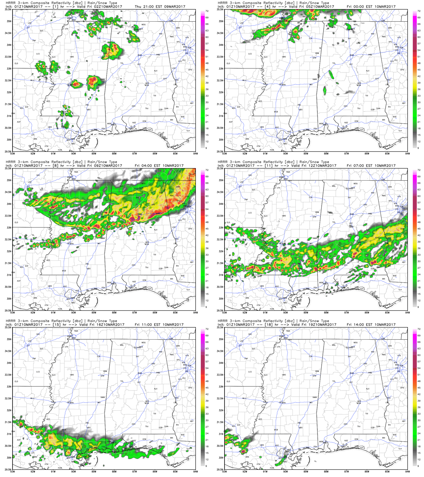
Here is approximate timing:
…12:30 a.m. Florence and Huntsville
….1:30 a.m. Jasper and Cullman
….2:00 a.m. Gadsden
….2:30 a.m. Tuscaloosa, Birmingham and Anniston
….3:30 a.m. Clanton
The line will start weakening after crossing I-20.
It will arrive in Montgomery by 5 a.m.
Damaging winds will be a threat, especially north of I-20. The greatest threat will be north of US_278 from Hamiton to Cullman to Gadsden.



