


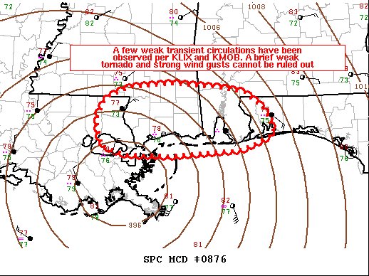
The latest Mesoscale Discussion from the Storm Prediction Center has just been released. Here is the text:
SUMMARY…A few storms have exhibited transient rotation as Tropical Storm Cristobal has made landfall. A brief, weak tornado cannot be ruled out and strong wind gusts are also possible. A watch issuance is not expected at this time.
DISCUSSION…Tropical Storm Cristobal made landfall over an hour ago and a few showers have exhibited some weak rotation. Storms are moving to west-northwest as rain bands move northward. Recently a couple of showers exhibited weak rotation in/around Mobile Bay but quickly weakened when they moved onshore. A brief, weak tornado remains possible to the north/east of the tropical storm center where low-level shear/helicity remains maximized. However, the tornado threat should be isolated. Localized convectively enhanced wind gusts are also possible within these rain bands. Given the marginal and isolated severe threat, a watch issuance is unlikely, but the situation will continue to be monitored.



